Solomon Islands: general information. Dangerous plants and animals
The Solomon Islands is highly rated in terms of diving activities. Beautiful coral reefs and colorful fish are found in the waters around the Solomon Islands. The underwater beauty of this island is a real treasure in the ocean. In addition, when diving in this place, you can find debris left over from the Second World War.
The Solomon Islands is an island nation located in the South Pacific Ocean, east of Papua New Guinea. The Solomon Islands includes 1,000 islands with a total area of 28,400 sq. km. The capital of the island, Honiara, is the main tourist destination in the Solomon Islands.
Solomon Islands landmarks
1. Waterfalls Mataniko and Tenaru
The city of Honiara, the capital of the Solomon Islands, is famous for its various attractions. Motaniko and Tenaru Falls is one of the best places in Honiara. The natural pool with clear water is a good place to swim. While walking and exploring this area, one can enjoy the beauty of its landscape.
Another place that attracts tourists is the National Cultural Center and Museum. It is located in the center of the island's capital. The Cultural Center and National Museum focuses on the traditional culture of the island.
Here you can find special sections dedicated to dance traditions, jewelry and the island's currency. In addition, many are attracted by the sections where the traditional weapons used by the locals and various archaeological finds are presented.
2. Harbor Aola Bay
The harbor of Aola Bay is one of the main ports and sea gates of the Solomon Islands, and among other things, is the first place from which to start exploring the islands, before heading to other cities and regions.
3. Provinces of Rennell and Bellona
Rennell and Bellona are the provinces of the Solomon Islands, which are two inhabited atolls, Rennell and Belona or Mu Nggava and Mu Ngiki respectively in the Polynesian dialect. In addition, they include an uninhabited Mandatory Reef. Rennell and Bellona are included in the UNESCO list, and the islands of Florida and Russell are known as the sites of many shipwrecks.

They are among other famous places visited by local and foreign tourists. This place offers many exciting and amazing places to visit.
4. Santa Cruz Island
The most important attraction of Santa Cruz Island is the Vanuatu rainforest. They are part of the ecological zone of Australia and here you can find a wide variety of tropical and subtropical moist deciduous trees. Therefore, you should not miss the opportunity to gain knowledge about the different types of trees growing in this amazing region.
Solomon islands- a state in the western part of the Pacific Ocean, east of New Guinea, located in the southeastern part of the islands of the same name.
The name of the country is associated with the legend of the country of Ophir, where the treasures of King Solomon are hidden.
Official name: Solomon islands
Capital: Honiara
The area of the land: 28 450 sq. km
Total population: 610 K people
Administrative division: The state is divided into 7 provinces and 1 city.
Form of government: A constitutional monarchy.
Head of State: Queen of Great Britain, represented by the Governor-General.
Population composition: 92% are Melanesians, 4% are Polynesians, 1.5% are Micronesians, 1% are Europeans.
Official language: English, pidgin (a mixture of Melanesian and English languages) is also common among the inhabitants of the country.
Religion: 45% of the population is Anglican, 18% Roman Catholic, 12% Methodist and Presbyterian. 9% are Baptists, 7% are Seventh-day Adventists, 5% are other Protestants. 4% of residents adhere to local traditional beliefs.
Internet domain: .sb
Country dialing code : +677
Climate

Subequatorial monsoon, very hot and humid.
The air temperature throughout the year is practically unchanged - + 25-30 C. From the end of April to the beginning of November (local winter), there is relatively dry and cool weather (+ 24-27 C), due to the southeastern trade winds blowing at this time ( sometimes the direction of the winds shifts to the northern or even western points - this is a clear harbinger of storms and hurricanes).
In summer (December-January-April-March) north-westerly winds prevail, and the air temperature rises to + 26-32 C with an air humidity of about 90%.
Up to 3500 mm of precipitation falls per year (in Honiara - 2250 mm). The maximum amount of rain falls in the period from December to March, and the windward shores of the islands both in summer and in winter receive 15-30% more precipitation than the leeward ones.
Hurricanes are most likely in summer, but most tropical typhoon paths run much east and south of the coast of the Solomon Islands, so here they are much less likely to reach destructive power than on more eastern islands.
Geography

An island nation in the southwestern Pacific Ocean, east of Papua New Guinea. It occupies the southeastern part of the Solomon Islands archipelago (with the exception of Bougainville and Buka, which are geographically part of the same archipelago, but politically belonging to Papua New Guinea) and nearby islands (a total of 992 islands and reefs, 347 of them are inhabited).
In the west (Murua Island and Pocklington Reef) and in the north (Nukumanu Atoll) it borders with Papua New Guinea, in the east - with Tuvalu, in the southeast - with Vanuatu (Torres Islands), in the south - with the French overseas territories (Bampton Reef , all maritime boundaries).
The Solomon Islands Group consists of six large islands (Choiseul, Santa Isabel, Malaita, San Cristobal, Guadalcanal and New Georgia) forming a double chain in the center of the archipelago, and approximately 20 medium-sized islands (Velha Lavela, Florida, Rennell, Santa Cruz, etc.), as well as a huge number of small islets and reefs scattered around them.
The group stretches more than 1,800 km from Shortland Island in the west to the Tikopia and Anuta Islands in the east and almost 1,000 km from Ontong Java (Lord Howe) in the north to Indispensable Reefs in the south. The Santa Cruz Islands (Vanikoro (La Perouse), Ndeni, Utupua, Tikopia, etc.) lie 230 km southeast of the main group.
The total area of the islands is 27.5 thousand square meters. km (1.35 million sq. km together with adjacent waters), thus it is the third largest island group in the region.
Flora and fauna

Vegetable world
Mangroves and coconut groves protect the coastal areas of most of the islands, while the interior is covered with dense rainforest with a colossal variety of plants - about 4,500 species grow on the islands, and new species are discovered every year.
Many of the coastal natural forests of the large islands have been cleared by agriculture and logging (timber exports account for up to 12% of the country's GDP), but the interior is still largely impassable due to high vegetation density and difficult terrain.
The mountains of the volcanic islands are covered with dense humid forests, which are home to valuable tropical trees. Low-lying areas are used for the cultivation of coconut trees, sweet potatoes, taro, yams, rice, cocoa and other crops (1.5% of the area is cultivated). Lowlands are often swampy. The vegetation of the northeastern plains of Guadalcanal is represented by savannas.
Animal world
The few endemic mammals (bats, marsupial couscous, rats and mice) are mostly nocturnal, so they are unlikely to be encountered. On the other hand, the crowns of the forest are literally teeming with all kinds of birds (about 223 species), insects (only about 130 species of butterflies), and all kinds of amphibians and reptiles (about 70 species) have found their homes under the canopy.
Every year thousands of rare birds, reptiles, amphibians, fish and butterflies are exported from the Solomon Islands for sale in Asia, North America and Europe. On the shores of the islands, the rarest sea turtles lay their eggs regularly (from November to February). The isolated group of islands of Santa Cruz has significantly less native flora and fauna than the main chain.

Dangerous plants and animals
There are many dangerous animals on the territory of the islands - these include numerous local blood-sucking insects that are carriers of many diseases, various arthropods (primarily the Javanese centipede and scorpions), some of 20 species of reptiles, as well as numerous species of poisonous fish and sea snakes.
It is recommended to move around the country accompanied by an experienced guide or guide, since the rugged local jungle is a potential source of threat in the form of many latently dangerous animals (for example, forest ants and leeches). The same rule is recommended for organizing dives in local waters.
sights

The main attraction of the Solomon Islands is nature.
Like neighboring Vanuatu, this land, still almost isolated from the outside world, is an example of amazing natural contrasts and endless possibilities for various adventures, where practically impenetrable jungles, high mountain peaks, mighty volcanoes, countless atolls, the purest mountain rivers with waterfalls coexist. and blue lagoons.
It is believed that no other Pacific archipelago has a more diverse nature with such a complex combination of geology and climatic conditions.
The archipelago is practically untouched by tourism, as there are few people on Earth who want to visit this poor and isolated country. But many are attracted here by the genuine naturalness of everything that happens to see or visit.
There is practically nothing artificial or created specifically to please tourists, and the nature of the islands, without unnecessary exaggeration called extraordinary, creates a reputation for them, perhaps one of the last places on the planet, as if specially designed for extreme types of recreation.
Here are truly unique conditions for diving, snorkeling, studying the history of the Second World War, ethnography, sailing and sport fishing.
Banks and currency

Solomon Islands dollar (S $, SI $ or SBD) equal to 100 cents. In circulation there are banknotes in denominations of 50, 20, 10, 5 and 2 dollars, coins of 1 dollar, as well as 50, 20, 10, 5, 2 and 1 cent.
Money can be exchanged at banks, specialized exchange offices (bureaux de change), some hotels, as well as in large shops and restaurants.
Exchange machines working with major world currencies can be found near bank offices and major stores in Honiara. National Bank of the Solomon Islands (NBSI) offers a full range of services for currency exchange and other transactions with it almost throughout the country.
In provincial areas, the easiest way to change money is at the branches of NBSI Bank, which has a network of approximately 50 local agencies, usually located in shops or post offices.
It is possible to use credit cards of the world's major payment systems (as a rule, they are served by three large banks in the capital - ANZ, Westpac and NBSI). In the provinces, it is difficult to use credit cards, it is preferable to pay in cash. There are three ATMs in Honiara.
Traveler's checks can be cashed at the offices of large banks (all the same ANZ, Westpac and NBSI) in the main cities of the country. To avoid additional costs associated with exchange rate fluctuations, it is recommended that you bring AUD or GBP checks.
Banks usually work from Monday to Friday, from 08.30-9.00 to 15.00.
Often US and Australian dollars are accepted for payment, especially in the southern regions of the country.
Useful information for tourists

The archipelago is almost untouched by tourism, few people visit this poor country, but they are attracted to the Solomon Islands by the genuine naturalness of everything that happens to see or visit.
There is practically nothing artificial or created specifically to please tourists. Those travelers looking for extraordinary natural conditions will not be disappointed by any part of this small country - the islands have a well-deserved reputation as arguably the best place in the world for scuba, snorkeling and fishing.
Tips are not accepted, but in case of good service, you can leave the staff 5% of the bill or an additional $ 1-2.
Black and red (the color of blood) are taboo on Laulasi and Bu-su, and visitors should take this into account when choosing clothes and jewelry for the trip.
Village life in the Solomon Islands is still surrounded by many taboos. It is impossible to explain the meaning of all of them, however, when visiting settlements, you should be careful and limit your curiosity as much as possible.
The term “taboo” means “sacred” (“holy”) as well as “forbidden”, so this is worth bearing in mind. Property rights are very important here - the tree, fruit or flower by the side of the road most likely belongs to someone. For many islanders, income depends on what they grow, so locals can expect decent compensation if you pick a fruit that was meant to be sold.
The clothing (or lack thereof) of the islanders may vary, but travelers must be fully clothed. In many areas, it is considered "taboo" for a woman to stand above a man, and even more so a man, even a foreigner, should not deliberately rank below a woman.
It is also forbidden to swim under a canoe in which there are women - it will probably have to be destroyed later, and for many islanders, canoes are the only means of obtaining food.
As in all cultures of the world, taboos play the role of moral precepts or codes and are intended to protect the community, therefore it is not customary to punish the uninitiated, which includes foreigners. Nevertheless, adherence to local customs is desirable.
It is believed that the first people appeared on the territory of the Solomon Islands about 30 thousand years ago, but the first organized agricultural settlements date back here to the fourth millennium BC. From that time until the 17th century AD, numerous Polynesian tribes rolled through this land in waves, going east, into the endless expanses of the Great Ocean. Some of them settled in the Solomon Islands, forming an amazing culture in which various Melanesian, Polynesian and Micronesian traditions have mixed. In 1568, the Spanish navigator Don Alvaro de Mendanha da Neira (or Mendana de Neira), after a three-month voyage in the Pacific Ocean, discovered a large island, which he named after the patron saint of his expedition, Santa Isabel, and then moved along the numerous islands of the land he discovered, inflicting them on the map and calling them Spanish names. Mendanha named this archipelago the Western Islands, or Isla de Solomon, in honor of the biblical king Solomon, and the largest of the discovered islands was named after the native village of one of the crew members - Guadalcanal (Alvaro de Mendanha da Neira himself died in 1595 from diseases on Santa Cruz during his second expedition to the islands).
Due to the little exploration of the archipelago region and its complex hydrography, the Europeans could not find the islands found by Mendanya for a long time, and only in August 1767, the British captain Philip Carteret mapped Bougainville, and D "Antrcasto surveyed the central part of the archipelago and finally identified Guadalcanal with the island , described almost two centuries ago. Then, for more than a hundred years, everyone has forgotten about the islands, except for missionaries and slave traders, but both the first and the second are fiercely rebuffed by local residents. The islanders quickly realized the danger posed by the white man, and began to kill anyone a European in their field of vision, which earned the islands a reputation as the most inhospitable land in the Pacific.
In 1893, Great Britain announced its protectorate over the archipelago, banning the slave trade and establishing a capital on Tulagi Island (Florida), on which a court was laid out, and a hospital, trade mission and club were built. And for another fifty years, everyone forgot about the Solomon Islands - until World War II, only Tulagi remained evidence of a certain European presence. But during the war in the Pacific, the word "Guadalcanal" entered all languages of the world - the islands became the scene of fierce battles between the Imperial Japanese Navy and the US Navy - from August 1942 to December 1943, 14 major naval battles died down here, and the bloody battles for Guadalcanal, Bougainville and Tulagi were included in all textbooks.
After the war, the nationalist (and pro-American) movement for Malaita independence opposed British rule. The mass repressions of 1947-1948 somewhat reduced the intensity of passions, but could not stop the struggle against colonial rule, and in the early 1950s the gradual transition of the Solomon Islands to independence began. In the early to mid-60s, Great Britain legalized local authorities, then regional assemblies were founded, and, finally, in 1970, a governing council was elected from among the local residents. The independence of the Solomon Islands was granted on July 7, 1978.
Like neighboring Vanuatu, this land, still almost isolated from the outside world, is an example of amazing natural contrasts and endless possibilities for various adventures, where practically impenetrable jungles, high mountain peaks, mighty volcanoes, countless atolls, the purest mountain rivers with waterfalls coexist. and blue lagoons. It is believed that no other Pacific archipelago has a more diverse nature with such a complex combination of geology and climatic conditions. The archipelago is practically untouched by tourism, as there are few people on Earth who want to visit this poor and isolated country. But many are attracted here by the genuine naturalness of everything that happens to see or visit. There is practically nothing artificial or created specifically to please tourists, and the nature of the islands, without unnecessary exaggeration called extraordinary, creates a reputation for them, perhaps one of the last places on the planet, as if specially designed for extreme types of recreation. Here are truly unique conditions for diving, snorkeling, studying the history of the Second World War, ethnography, sailing and sport fishing.
Guadalcanal
The island of Guadalcanal, or Guadalcanal, is the largest land area in the Solomon Islands group (5302 sq km). Rising from the depths of the ocean like some kind of prehistoric lizard, the mountainous and inhospitable island is almost entirely occupied by the slopes and peaks of ancient volcanoes (Mount Gallego, or Mount Gallego, Popomanaso, Makarakomburu, Tatuve, Kaichui - they all have a height of 2 km or more) and is covered with a dense cover of tropical vegetation. Its mountainous relief leaves no other place for people to live, except for a very narrow coastal strip surrounding the entire island, only in the north, in the area of Henderson Field (Henderson) and Honiara, which turns into a small plain. The southern coast is rocky and bears the semi-official name of the Weather Coast ("Weather Coast"), since the life of people here depends entirely on the state of the weather. Swampy shores and a hot and humid climate make life on Guadalcanal extremely difficult, but it is here that about 40% of the country's population lives, the capital of the archipelago and its main administrative institutions are located.
Honiara
The capital of the islands is located on the northern coast of Guadalcanal, in a vast bay between the Cape Esperance and Lunga Point peninsulas, in the very place that de Mendanha once called Puento Cruz. The small and quite picturesque seaport of Honiara originates from a tiny fishing village, whose name Naho-ni-Ara can be translated as "a place where east and southeast winds collide" (for local dialects such "flowery" names are generally very characteristic) ... The city is very young - most of its modern buildings were built immediately after the end of World War II, when it was necessary to find a place for the new capital of the archipelago (Tulagi was badly damaged during the fighting, and the place for it was not the best choice). In 1952, Honiara officially became the capital of the Solomon Islands.
Honiara is, perhaps, the only more or less large settlement of the archipelago - apart from fifty thousand local population, concentrated on an area of barely 1.5 square meters. km, residents of other islands constantly come here for shopping, work and leisure. Most of his life is in full swing along the Cookum Highway, which connects Henderson Field in the east with White River in the west. Along this route and the main street of the city, Mendana Avenue, which continues it (Mendana is how the islanders pronounce the name of the discoverer of their islands), almost all the main infrastructure of the capital has been rebuilt - the National Hospital, the complex of port facilities, the market and the recently badly damaged Chinatown.
The National Parliament Building, opened in 1993, stands out sharply from the surrounding buildings with its conical shape and is considered the center of Honiara. Today, the restored old Government House is given over to the National Museum complex with an extensive collection on the history and culture of the country, and its park serves as a popular place for afternoon relaxation. Opposite is the original building of the Solomon Kitano Mendana Hotel, and between it and the yacht club is the country's Tourist Office. Nearby are the National Archives (the largest collection of historical material on the country, open to the public from 9.00-10.00 to 16.00-17.00) and the Public Library behind the Office of Public Works.
The large modern building of the Central Bank of the Solomon Islands has an original historical exposition that tells, as you might guess, about the peculiarities of the local monetary system - it displays traditional money for the countries of the region in the form of bunches of red feathers or cowrie shells, as well as a small exposition of works by local woodcarvers ...
A little further down Mendana Avenue, between the office of the Solomon Islands Broadcasting Corporation (SIBC) and Rove Prison, begins the Honiara Botanical Gardens, famous for their collection of native plants (the area of the gardens is quite small, and the collection looks modest at first glance, but to appreciate its importance , it is enough to imagine what forces it would be worth to see all these orchids and vines in natural local conditions). Here, on Mendana Avenue, in a small park located almost opposite the Central Bank building, there is a Melanesian Cultural Village with its typical local buildings of palm leaves and wicker mats. This colorful mini-museum specializes in showcasing the traditions, rituals and crafts of various areas of the Solomon Islands.
The ever-bustling and colorful markets selling vegetables, all kinds of tropical fruits, fish, betel nut, shells and handicrafts can be found all week around the town's pier, as well as in the Rove and Cucuma (suburbs of Honiara). An excellent fish market is also located in Fisherman Village, or Lau - a small fishing village 5 km from the city, inhabited mainly by immigrants from the province of Malaita. Even if you don't like any of the goods, these places are worth visiting just in order to observe the everyday life of the islanders, their colorful culture and language, because merchants from the most remote villages of the archipelago gather here. And the commercial heart of the city is Chinatown, or Chinatown, located almost in the city center, near the Matanikau Bridge. Badly damaged during the recent riots, it still remains a fairly picturesque area of warehouses, shops and numerous mini-mansions built in the traditional "colonial style" with wooden verandas and iron roofs.
Many tourists note that the first impression of Honiara is quite disappointing - a rather dusty and unprecedentedly quiet city practically does not have any outstanding monuments of history or culture. One day is enough for exploring all the sights of the capital, as well as bypassing most of the local markets and craft shops. However, the capital is the only place from where you can go on an excursion around the island, and where, most likely, you will have to return, since there are no more or less decent accommodation facilities outside of it. However, many people remember it as one of the most isolated places on earth, where you can sit in a restaurant or bar with a clear predominance of traditional seafood dishes, wander along the shore or fish right from under the canopy of palm trees surrounding any institution or private house. And a little to the west of the coastline, near the town of Poha, there is a good Bonigi beach and the Experimental Station for the Study of Giant Mollusks (ICLARM) - a kind of farm for these relict marine inhabitants, always appreciated by the locals for their taste and therefore on the verge of extinction.
Around the capital
To the east of Honiara is the complex of the Betikama church school, widely known for its handicraft workshops (pottery, metal and woodwork, most of which can be bought on site) and a small museum of World War II relics. Nearby lies the village of Tenaru, near which the sixty-meter waterfall of the same name is rustling. The village of Mavasere, which is considered the center of the Moro movement, is located 7 km east of the capital. A small museum deserves attention here, designed to preserve the historical and spiritual values of traditional local life. Farther east, between Guadalcanal and the tiny island of Tavanipupu, stretch the waters of the Marau Sound with their huge coral reefs, which are teeming with various marine life.
The most beautiful "double-sided" waterfalls of Mataniko lie 10 km from the capital. The waters of the river of the same name break down here from a high cliff right into a cave filled with graceful stalactites and stalagmites, and then disappear somewhere in the bowels of the island. Around you can find many fairly large and, importantly, clean bodies of water suitable for swimming, and the cave itself is home to a vast population of swallows and bats. During the Second World War, this cave served as a shelter for the last soldiers of the Japanese garrison of Guadalcanal, and its surroundings became the scene of fierce battles (according to various estimates, from 400 to 600 soldiers of the imperial army found their death in the cave itself, resisting literally to the last bullet).
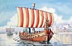
The battlefields of the Second World War are generally among the main attractions of Guadalcanal in general and the surrounding area of Honiara in particular. It was in these places that the most fierce battles between the Japanese garrison of the island and the US Marines outnumbered by several dozen times were in full swing. The Henderson Field International Airport (Henderson Field, named after a major in the US Marine Corps who died during the Battle of Midway) itself dates back to the runway, which the Japanese began to build and the Americans were already completing. It was for this piece of land that stubborn battles unfolded, during which both sides suffered the most tangible losses (according to various estimates, from 24 to 38 thousand people on land alone). Therefore, it is not surprising that traces of that war are still found in abundance around the capital and the airport, and the nearby waters are literally littered with fragments of various military equipment. Interestingly, one of the straits leading to Guadalcanal still bears the completely official name of Iron Bottom ("Iron Bottom"), and the government of the Solomon Islands was even going to present an invoice to the United States and Japan for clearing it from the wreckage of ships and aircraft. appreciated the profit that can be derived from visiting these places by tourists, as well as amateurs of military history and divers from these countries.
On the Skyline Ridge and Mount Austin, there is the American Memorial Park with detailed descriptions of the battles for the island, as well as the Japanese Peace Memorial with its four white monoliths. From here, organized tours are organized to places whose names speak for themselves - the Iron Bottom Sound, Bloody Ridge, Alligator Creek and Red Beach, the Japanese memorial at Poha River and its Wilu Village Museum (also dedicated to the history of the battles for Guadalcanal), Cape Lunga Point and Tetere Bay.
The southern coast (Weser Coast) is quite deserted and underdeveloped. Of all its attractions, only the town of Tulagi (not to be confused with the old capital of the archipelago on the island of Florida) with its handicrafts and good conditions for sea fishing can be noted, as well as the village of Komuwaulu, another center of the Moro movement with colorful local architecture and a tiny museum. And deep in the heart of the Guadalcanal rainforest, on the slopes of the Lhamas (Lamas) mountain range, the luxurious Vihona (Viona) waterfalls, unfortunately accessible only by helicopter, rustle.
Central area
Covering an area of about 1000 sq. km The Central Region lies around Guadalcanal and includes the islands of Savo, Russells, Ngguela and the Florida group. Once serving as the center of the archipelago (the old capital of the Solomon Islands, the town of Tulagi, is located on the island of Florida), after the Second World War it practically lost its significance, since many infrastructure facilities were destroyed during the fighting, and those that were built by the fighting armies were clearly temporary and quickly fell into disrepair. Therefore, most of the modern sights of the region are associated either with traces of those battles, or with the sea and good local shores.
The volcanic island of Savo, constantly shrouded in clouds, lies in the Iron Bottom Sound and is a haven for divers and fans of other outdoor activities. The almost complete lack of infrastructure is compensated by an abundance of sunken ships (this is where the famous Battle of Savo Island took place), a constantly smoking volcano crater and many practically boiling mineral springs, several ancient cult sites - megapods, as well as a living bird community and magnificent crystal-clear waters. On the island of Florida, you can see the old headquarters of the British colonial administration with its hospital and headquarters, as well as the old Port Parvis, which first served as a base for the British Navy, and then for the Japanese Imperial Navy. And Anukha is widely known for its white sandy shores.
Malaita Region
The eastern province, named after the largest island in the group, is the second largest and most densely populated of the Solomon Islands, although many of its inhabitants do not live in large cities like Honiara or Guizo, but in villages and towns lost in the jungle and on islands. The large islands of Malaita are inhabited by Melanesians (about 96 thousand people), and Polynesian tribes (about 2 thousand people) live on the atolls of Ontong Java (Lord Howe), Ronkador, Cucuman and Sikaiana. It was these islands that made the maximum contribution to the reputation of Solomon as inhospitable islands, and for the same reason, it was here that ancient folk traditions and rituals were preserved as much as possible.
A distinctive feature of the island of Malaita is a huge number of artificial islands that have been built by local residents since ancient times right on the atolls or rocky islets of lagoons. The lack of land suitable not so much for cultivation - just for housing, forced the Malitians from century to century to fill artificial shores of crushed coral or rubble between piles driven into the bottom, which the sea very quickly turned into a fairly solid monolith. Nowadays, about 12 thousand islanders from 15 tribal groups are concentrated on these man-made islands, especially widespread in the Langa-Langa and Lau lagoons, and one of the last relict tribes of the planet - the quayo (kuaio) group - lives in the mountainous regions of Malaita. It is in these places that the most ancient cult of shark worship has survived, in which, according to local beliefs, the souls of ancestors inhabit. Sharks are treated with respect by the locals and many of these ancient cartilaginous fish serve as totemic signs of tribes and clans.
Sharks are worshiped in many areas of the Solomon Islands, but no island has more rituals and festivities dedicated to this marine predator than the Laulasi and Busu Islands in the Langa Langa Lagoon, which lie 16 km from the island's capital, Malaita. From Auka, you can get by boat to the artificial islands of the lagoons and witness here the ancient rite of the practice of "summoning a shark" or a rather dangerous method of catching it, when a diver, armed only with a rag and a spear (or knife), enters into a one-on-one confrontation with this formidable marine predator. Although more often tourists are shown an equally shocking sight of communication with a shark. Many locals tame sharks, from the smallest nurse sharks to the largest and most formidable of them. The practice of "summoning a shark" is an ancient art of luring a predator, and somehow local sorcerers manage to put a shark to sleep right in the water and then raise them manually to the surface !! Knocking on rocks in certain places under the water lures sharks to a depth of 30 cm, where a little boy (surely !!) gives a predator, who can bite it in half in the blink of an eye, a piece of pork, thanks to her for the visit. The shark then continues to swim in circles around the lagoon, as if accepting the gift. This ritual, as extremely dangerous, was banned in the 1970s, but some parts of this amazing custom are still practiced in many places. Since pig meat is black in color, black and red (the color of blood) are taboo on Laulasi and Busu (and on many other islands in the region as well), and visitors should take this into account when choosing clothes and jewelry for the trip.
The small town of Auki (population about 4 thousand people) has been the capital of the Malaita region since 1920. Until the 1920s, the city had an impressive defensive wall around its entire perimeter, capable of holding off attacks from hostile local residents or even well-armed Europeans for a sufficiently long time, which predetermined its choice as the capital. Today's Auki is perhaps the most photogenic city in the country and boasts a decent selection of shops, hotels and restaurants for these places, plus good, even by local standards, cuisine. From here you can reach the village of Lilisana in the Langa-Langa lagoon (it is believed that the inhabitants of this particular settlement invented the technology of making pile buildings and artificial islands), to the beautiful beaches of the lagoon itself, to the picturesque cultural villages of Alite, Anoano, Aofia, Aumea, Maeaena, Manaaf and Uru (a preliminary agreement on a visit is required), as well as to the already mentioned cultural village of Busu, which, in addition to rituals with sharks, is able to offer many other interesting rituals.
Western Region
The western province is considered the recognized leader of the country for the beauty of its shores and the wealth of the underwater world. The largest of the provinces of the archipelago, it occupies 8,573 square kilometers (the islands of Velha Lavella, New Georgia and about fifty small islets and reefs), and only 19% of the population lives here. Often called in conversations simply West ("West"), it attracts many fans of extreme and water sports, it is also, perhaps, the most developed region of the country in terms of recreation infrastructure - about 16 quite modern resorts have been built here, clearly focused on diving, including one of the best in the country Uepi Island Resort in the famous Marovo lagoon.
The largest salt lagoon in the world (its size is about 150 by 96 km), Marovo is located on the island of New Georgia to the north of Wangunu Island (in fact, it is a strait between these two islands, transformed by the growth of coral reefs into a discontinuous ring of land surrounding the central lagoon). This huge body of water with a narrow strip of coral beaches around the perimeter and amazingly blue water is a candidate for inclusion in the UNESCO World Heritage List. Literally thousands of islands line the Marovo Lagoon, from tiny coral reefs to massive volcanic cliffs up to 1,600 meters high, many of which still show signs of active volcanic activity, but are quite accessible to the public. Lagoon Marovo - the best place to relax by the sea, is a unique combination of scenic beauty of wildlife and rich traditions of local residents (the shores of the lagoon are inhabited by two separate tribes - Marovo and Roviana). Noteworthy resorts are Matikuri Resort, Rogosakena Eco Resort and Uepi Island Resort, as well as a section of the traditional World Heritage Village, considered the best tourist village in the country. Logging is limited here, in order to preserve the unique composition of flora and fauna inherent in this area, excellent conditions for sea fishing have been created (the lagoon is connected with the open sea by almost a hundred passages in the reefs, so the species composition of its inhabitants is more than impressive), and traditional crafts of local residents from wood and shells are widely known far beyond the borders of the country.
The second largest city in the archipelago - Gizo is located on the island of the same name (approximately 370 km from Honiara), on the shores of the Vona Vona lagoon, and is considered the capital of the Western region and one of the most popular resort areas in the country. Its snow-white isolated shores and beaches, numerous coral islands and atolls literally growing from the depths of the ocean, traditional villages and excellent conditions for sea fishing, snorkeling and diving have made it famous among fans of outdoor activities. At the same time, the island itself does not differ much in its level of development from what the fighting parties saw during the Battle of Guadalcanal. On Guizo, you can rent a private boat and explore the magnificent coral reefs of Vona Vona or New Georgia lagoon, dive to the numerous ships and aircraft that died in these waters during the last war, climb the Kolombangara volcano (1770 m), and also see the megapods - an ancient shrine of local tribes, a crocodile farm, the Nusambaruku pile village or visit the dance festival in Mbangopingo.
Plum Pudding Island, or Kennedy Island, which gained its fame after the sinking in August 1943 of the PT-109 torpedo boat, commanded by the future US President John F. Kennedy, is a favorite, albeit rather unsophisticated point of attraction for most tourists. his team fled to this tiny piece of land (now in his honor there is an annual swim competition for the JFK prize). You can also take an excursion to the small fishing village of Malaita, inhabited by immigrants from other regions of Oceania, - this is an excellent opportunity to observe various cultures, peacefully coexisting for many centuries, just a short walk from each other. However, you can get to most of the local villages here only by boat or along narrow, often almost impassable roads under the crowns of a dense forest.
Choiseul region
Choiseul Island, or Lauro, only recently (1995) separated from the Western Province into a separate administrative region. Its population is also heterogeneous, as in other parts of the country - about 16 thousand Melanesians live in the western half of the main island, and in the east and north there are people from the Gilbert Islands (about 2 thousand people). Most of the coast of Choiseul is an extremely narrow strip, bounded from the land by mountain ranges and jungle, and from the sea - by large shallow swamps and literally a wall of moisture-loving vegetation. Therefore, it is quite difficult to explore it, and all excursions are conducted either along the Choiseul Bay, the Sui River with its waterfalls and the tiny capital of Kumbakale, near which the shores are more favorable for movement, or by sea - in the form of a week-long cruise along the coast of the island with visits to local villages and diving under the water (however, apart from good reefs, there is nothing remarkable here - the Second World War was fought much southeast of this region).
Isabel Region
The Spanish explorer lvaro de Mendanha da Neira discovered the island of Santa Isabel in February 1568 and set foot in the bay that is today called Estrella Bay. Almost 75% of the local population, mostly Melanesians, belonging to six tribal groups, live in the southeastern part of the island. The longest island of the archipelago, Santa Isabel is still quite little explored, which is largely due to the almost complete absence of roads (the only section that deserves the name of the road stretches from the capital of the island of Buala to the village of Kaewanga on the southern coast), so all movement between the settlements of the island conducted by sea. There is also a center for excursion activities, the most popular object of which is the island of Arnavon (Amavon), also known as "Turtle Island", because it is here that the natural breeding zone of the Bissa - the rarest sea turtles - is located. None of the nearly one hundred islands and reefs of the Arnavon group, stretching between Santa Isabel and Rob Roy Island, is permanently inhabited, many rise only a couple of tens of centimeters above sea level, so this area can also be proud of unrivaled fishing. In 1991, the Arnavon Marine Nature Reserve was established here, whose area stretches from the coast of Santa Isabel to Choiseul. When visiting the territory of the park, visitors are accompanied by a whole staff of specially trained guides from among the residents of local villages (2 people from each community), who only monitor the behavior of tourists and control the life of turtles - the local population is so vulnerable and has not yet fully recovered after many years of extermination of these unique animals that such behavior of the staff is simply necessary.
Also noteworthy are the Chia pile village in the north of the island, all movement along which is carried out by canoe, and the southwestern island of São Jorge (São Jorge, known in local mythology as the habitat of the spirits of the dead - various strange phenomena are indeed frequent here). Most of the local villages have good mini-hotels with excellent service by local standards and level of income, and the main souvenir from these places is a fabric made of tapa bark (paper mulberry), dyed blue with the juice of local orchids.
Makira region
The most southeastern region of Solomon includes the islands of Makira (San Cristobal), Ulawa, Uki-Ni-Masi, Ovaraha (Santa Ana), Owariki (Santa Catalina) and a dozen other small patches of land stretching towards Vanuatu ... A fairly compact island group (all islands are at a distance of about 35-38 km from each other, with the exception of Ulava, which lies 75 km south of San Cristobal) occupies an area of about 3188 sq. km and is inhabited by 30 thousand people (two thirds of them live on the northern coast of San Cristobal). Mountainous (up to 1040 m in San Cristobal) and very swampy islands are literally cut by rivers and streams (almost every 2-5 km a watercourse flows into the sea), being considered the "dampest" in the country. Since the islands were isolated from the outside world for a long time, many relict forms of plants and animals have been preserved here, the same applies to people - the Bauro tribal group is considered by scientists to be one of the most isolated and conservative ethnic groups in the region.
The main fame of the islands was brought by local masters of folk dances - almost every village has its own troupes, widely known far beyond the borders of the Solomon Islands. The most colorful dance performances with almost complete preservation of ancient traditions can be seen in Star Harbor, in the village of Natanger, on the islands of Ovaraja (Santa Ana), Ovariki (Santa Catalina), Tri Sister and Ulava. Here you can also buy products of folk applied crafts. And in the mountainous regions of San Cristobal, teeming with caves and extremely inaccessible, according to the locals, the "dwarfs of the Pacific Ocean" - a dwarf race "Kakamora", to which all sorts of mythical properties are attributed, still live.
Region Temotu
Formerly called the Eastern Outer Islands, the Temotu region covers an area of 926 square kilometers. km (islands) and 150 thousand sq. km of ocean in the easternmost part of the Solomon Islands. This vast archipelago of widely scattered islands is separated from the main group of the country by the Torres Basin, with depths of up to 600 m. to the east by the isolated extinct volcanoes of the islands of Duff, Tikopia and Anua. This area is virtually untouched by modern civilization, and the islanders inhabiting it differ in their origin from the inhabitants of the rest of the Solomon Islands. The only attractions here are the active volcanoes of Tinakula Island, the colorful rituals of local tribes (it is typical that bunches of red feathers of tropical birds are still used as a currency here - one of the most unusual currencies on the planet), the village of Bol on Santa Cruz with its unusual the population, in whose veins the blood of Spanish sailors flows from the ships of Alvaro de Mendanha (it is here that the navigator himself and 47 members of his crew are buried), as well as the beautiful Gulf of Graciosa.
Rennell and Bellona Region (Renbel)
The southernmost island group, set aside in 1995, Rennell and Bellona lies south of Guadalcanal and southwest of Makira. These remote atolls were discovered by merchant captain Matthew Boyd in 1793. Now this area, covering an area of 671 sq. km and inhabited by only 2.5 thousand people, it is one of the natural
A country in the Pacific Ocean on the archipelago of the same name - the Solomon Islands!
Solomon Islands is the name of an archipelago and state located in the Pacific Ocean, east of Papua New Guinea. The Solomon Islands consists of 6 large and 992 small islets, atolls and reefs, and extends over almost 30 thousand square kilometers. It occupies an important position at the crossroads of the sea routes between the South Pacific, the Solomon and Coral Seas.
Tours to the Solomon Islands
The State of Solomon Islands is a British protectorate and occupies most of the archipelago. The highest point is on the island of Guadalcanal. This is Mount Makarakombu with a height of 2447 meters. One of the most isolated islands - Santa Cruz - is located north of Vanuatu, and 200 km from other islands.
Car Rentals in Solomon Islands
There is a version that about ten thousand years ago the Solomon Islands were inhabited by Melanesian tribes. The first European to set foot on these lands in 1568 was the Spanish explorer Alavaro Mendanha de Neira. He decided that he had found the mythical country of Ophir, where, according to legend, the treasures of the Jewish king Solomon were hidden. This is where the name of the Solomon Islands comes from.
The capital and largest city of the Solomon Islands is Honiare. It is located on the island of Guadalcanal. It is home to about 54 thousand people, and the population of the islands as a whole is about five hundred thousand inhabitants. By the way, it is easy to rent a car in the Solomon Islands directly on our website, and also buy tours to the Solomon Islands, especially since they are quite inexpensive!
The official name is Solomon Islands.
Located in the Southwest Pacific Ocean. The area is 28 450 km2, the population is 509 thousand people. (2003). The state language is English. The capital is the city of Honiara (55 thousand people, 2003). National holiday - Independence Day on July 7 (1978). The monetary unit is the Solomon Islands dollar.
Member of the UN (since 1978), IMF (1979), WTO (since 1994), Pacific Islands Forum (formerly UTP).
Located between 5 ° 10 and 12 ° 45 S and 155 ° 30 and 170 ° 30 E in the Solomon Islands archipelago (excluding the Bougainville and Buka Islands, which are part of Papua New Guinea), the Santa Cruz island group, other groups and individual islands (922 islands in total). The largest: Guadalcanal (5.6 thousand km2), Makira (San Cristobal) and Santa Isabel (4.7 thousand km2). The length of the archipelago is approx. 1500 km. The length of the coastline is 5313 km.
To the northwest and west of the archipelago is Papua New Guinea, to the southeast - Vanuatu.
Solomon Islands landmarks
In the west, the archipelago is washed by the Solomon Seas, in the southwest - by the Coral Seas.
The Solomon Islands are volcanic, high (mostly), and coral, low, islands. On the high islands there are extinct and active volcanoes, hot springs, and earthquakes are frequent. Mountain ranges occupy almost all of their surface (the highest point is Makarakomburu, 2294 m, Guadalcanal). There are deep narrow valleys between the mountains. Narrow lowlands stretch along the coast. Many volcanic islands are surrounded by coral reefs. The large islands have many mountain rivers suitable for the construction of hydroelectric power plants. There are few lakes, but Lake Tinggoa (the coral island of Rennell) is the largest in Oceania. The high islands are covered with dense forests of valuable tropical species. The fauna is not rich: possum, wood mouse, large gopher (found only here). Crocodiles live in mangrove swamps. St. 150 species of birds (especially a lot of parrots). The surrounding waters are full of fish, sea turtles, snakes, and molluscs.
Minerals: In the 200-mile economic zone (1.63 million km2) - one of the world's largest concentrations of tuna. There are reserves of lead, zinc, nickel and gold.
The climate is tropical. Hot and humid season: November-March (showers, hurricanes). The average annual temperature is + 23-27 ° С. The average annual precipitation is 2000-3000 mm (in some places - up to 8000 mm).
Population growth rates - up to 3% per year. The composition of the population: Melanesians (93%), Polynesians (4%), Micronesians (1.5%), there are Europeans (0.8%), Chinese (0.3%), etc. The main language of interethnic communication is pidgin (Anglo-Melanesian version). Not more than 2% of residents speak English. The indigenous population uses approximately 120 languages and dialects. Very strong communal, clan and family ties remain. 90% of the inhabitants live in small villages and are engaged in subsistence or semi-subsistence agriculture. Competently 65% of the adult population. Life expectancy for men is 70, for women - 75 years. Child mortality 23 people. per 1000 newborns.
Among believers, Christians predominate, mainly Protestants (78%), incl. Anglicans - 45%. Catholics - 18%, adherents of traditional beliefs - 4%.
The first of the Europeans to visit the archipelago was the Spaniard A. de Mendanha (1568). Assuming that he had found the fabulous land of the biblical king Solomon, he named the archipelago Solomon Islands. Only 200 years later, other European navigators began to study them. Bloody clashes between slave traders and indigenous people served as a pretext for Great Britain to establish a protectorate over the archipelago and nearby islands in 1893-1900 (some of them were ceded to it by Germany in 1900). Indigenous unrest continued until World War II, when the Japanese occupied the Solomon Islands. In 1942 - 43 islands - the site of fierce battles (especially Guadalcanal) of American troops and their allies with Japanese troops. After the war, under the pressure of the struggle of the indigenous people for independence, the development of self-government began. In 1974, the first elections to the Legislative Assembly of the Solomon Islands were held. In 1976 they received the status of internal self-government, and in 1978 - independence. Due to periodic outbreaks of interethnic clashes, the internal political situation remains extremely unstable. So, at the end. 1998, another unrest broke out on the island of Guadalcanal, caused by the discontent of local residents (isatabu) with the flow of immigrants from other islands of the archipelago (primarily from the neighboring, most populated island of Malaita) and the related seizure of land, an increase in crime, etc. More than 20,000 Malays were expelled from Guadalcanal. In response, Malay paramilitaries forced the then prime minister to resign in June 2000 and seized control of the capital. Despite the fact that the end. In 2000, a peace agreement was reached, and in December 2001, new elections were held, lawlessness continued to reign in the country. The new government authorities have repeatedly called for the introduction of a UN peacekeeping force or the Pacific Islands Forum into the country. Finally, on July 24, 2003, an advance detachment of Australian troops as part of the joint Forum forces landed on Guadalcanal (they also included parts of Papua New Guinea, Fiji, Tonga, Samoa and New Zealand) to restore law and order in the archipelago.
Solomon Islands is a parliamentary democracy within the Commonwealth of Nations (formerly British). The head of state is the Queen of England (at the same time, the Queen of the Solomon Islands). She appoints the governor-general on the recommendation of the local parliament, whose 50 members are elected by popular vote for a 4-year term (next election in 2005). The executive power belongs to the Prime Minister (A. Kemakez), who is approved by the parliament together with his deputy and ministers (all members of parliament).
Administratively, the country is divided into 9 districts (provinces) and the city of Honiara.
Main political parties: People's Alliance Party (leader A. Kemakeza, 16 seats in parliament), Union of Solomon Islands for Coalition of Change (13), Progressive People's Party (2), Labor Party of Solomon Islands (1), etc.
There are no regular armed forces, only police and intelligence.
Solomon Islands has no diplomatic relations with the Russian Federation.
GDP per capita US $ 1.7 thousand (at purchasing power parity, 2001). The internal political chaos of recent years has hit the economy hard. If in 1984-93 the average annual GDP growth rate was 3.5%, and in 1994-96 - even 7.7%, then in 1997-2002 the volume of GDP decreased by almost 20%. Over 70 percent of the economically active population is engaged in semi-subsistence agriculture. Cocoa beans, coconut trees, rice, potatoes, vegetables and fruits, etc. are grown. The population breeds pigs and poultry, and cattle are raised on farms. In the commodity sector of the economy, agriculture, forestry and fishing account for 24% of the employed, industry - 13%, services (trade, finance, government, etc.) - more than 60%.
There are enterprises for the production of canned fish, clothing, furniture, souvenirs, woodworking.
Of the more than 1360 km of roads, only 34 km are paved, and 800 km are roads inside private plantations. Coasters ply between the islands. The main seaport is Honiara. There are several ports and harbors. Of the 32 airfields, 2 have hard-surface runways. International airport - in the area of Honiara. Internet users - 8.4 thousand people. (2002).
Potential tourism opportunities are poorly used, there are only 10-11 thousand foreign tourists a year. In addition to the underdeveloped transport and other infrastructure, the main obstacle to expanding the flow of tourists is the unstable internal political situation.
Copra, palm oil, fish, timber, cocoa are exported. Food and fuel, finished products, machinery and equipment are imported. Foreign economic partners: Japan, Australia, South Korea, the countries of Southeast Asia, etc.
Foreign financial assistance (Japan, Australia, New Zealand, PRC) plays an important role.
School education is still optional. Only 21 out of more than 500 secondary schools. The College of Higher Education prepares teachers, accountants, paramedics, and fisheries specialists. But residents actually receive higher education in Fiji, Papua New Guinea, Australia and New Zealand. Honiara is home to the University of South Pacific Marine Resources Institute (Fiji).