Spitsbergen is a Russian territory. Polar archipelago Svalbard. Where is the island of Spitsbergen located? Who owns the island of Spitsbergen?
The question is, what did they need in this God-forsaken region? Blubber! Whale oil, which since the beginning of the 17th century has become one of the most sought-after goods in Europe. Blubber was, in fact, the oil of that time. It was the main lighting material for lamps almost until the end of the 19th century, until it was replaced by kerosene. Wealthy Europeans abandoned fire-hazardous wax candles and switched to more technologically “advanced” lamps. Surprisingly, this fact directly influenced the way of life of Europeans. Thanks to the blubber obtained in the distant Arctic, they began to go to bed later, read more, and most importantly, work more, since lighting in the artels using whale oil was cheaper than “wax” lighting.
Interestingly, the spread of blubber in Europe was extremely unprofitable for the Moscow state, which was one of the main exporters of wax. However, in Rus' at that time there were few officials who could think in terms of global economic strategy.
It all started with Willem Barents, who in the summer of 1596 discovered a rocky coast in the Arctic waters, which he named Spitsbergen (“sharp mountains”). It is curious that at that time the Dutch sailors considered that the land was part of Greenland, and therefore did not lay claim to the “great geographical discovery”. Probably, the name “Spitsbergen” would have “fallen asleep” in the Barents logbook if the Dutch had not discovered a huge pod of bowhead whales in the coastal waters. It was a billion-dollar discovery! And that's why...
Whaling in Europe by that time flourished in the Bay of Biscay. The main whalers in Europe were the Basques, who learned to use a harpoon in the early Middle Ages. When whale oil, in the second half of the 16th century, gained massive demand in Europe, the Biscay whale fishery turned into mass extermination. As a result, over several decades, the population of these marine mammals was on the verge of extinction. And now Barents opens a new rich “deposit”. Returning to their homeland (though without the tragically deceased Willem Barents), the expedition members find investors, and after some time the first Dutch whaling expedition is sent to the Arctic waters.
English vs Dutch
While the Dutch were gathering an expedition, the British made their discovery of Spitsbergen. In 1607, the archipelago was contemplated by Henry Hudson, who was then working for the British Muscovy Company (Moscow Company), which received a monopoly on trade with Russia from the Russian monarchs. Hudson also noted a large population of whales in coastal waters, which he reported on his return to Britain. And 3 years later, another employee of the Muscovy Company, Captain John Poole, noted the “incredible abundance of whales” in the waters of Spitsbergen.

Sensing a gold mine, a British corporation with a Russian name in 1611 sent the first whaling expedition, reinforced by Basque harpooners. However, two ships suffer disaster. But the English “Muscovites” do not give up, and next year they are preparing a new expedition to Spitsbergen. And here a surprise awaits the British sailors: in the waters of the archipelago they meet Dutch and French whaling ships. In 1613, the Muscovy Company decided to end competition once and for all by sending 7 warships to the shores of Spitsbergen, which dispersed several dozen Dutch, Spanish and French ships. This led to international political conflict. The Dutch, Spanish, and French insisted that the waters of Spitsbergen (all participants called it Greenland) were neutral waters, and the British had no right to a monopoly. In addition, representatives of the Netherlands even declared their advantage, since it was Barents who discovered Spitsbergen. Representatives of the Muscovy Company, in turn, argued that they received exclusive rights from the “Moscow sovereign.” They say that since the end of the 15th century this land has belonged to the Russians, who even organized settlements there.
Indeed, there is even a letter from the German geographer Hieronymus Müntzer to the Portuguese King João II, written at the end of the 15th century, which talks about recently open island Grumland (as the Russian Pomors called Spitsbergen), which is part of the domain of the Grand Duke of Moscow. Danish admiral Severin Norby, who visited Moscow in 1525 and 1528, reported to King Christian II about Grumland, which belongs to Vasily III.
But the king of Denmark and Norway, Christian IV, joined the dispute, who said that these Arctic territories from time immemorial belonged to the Norwegians and were called Svalbard. As an argument, an excerpt from an old Norwegian chronicle was cited that in 1194, not far from Iceland, Scandinavian sailors discovered a land that they called “Svalbard” (“cold shores”).

Already in the 20th century, researchers would question this fact. Perhaps someone sailed from Iceland at the end of the 12th century and came across some “cold shores”, however, most likely, brave sailors then called Svalbard the area in the east of Greenland or the island of Jan Mayen, which have nothing to do with Spitsbergen.
It is not known whether the British believed in the Norwegian legend, but in 1614 they offered the monarch of the Danish-Norwegian state to buy the monopoly right to the island. Christian IV rejects the offer, and in 1615 3 Scandinavian warriors land on Spitsbergen in order to collect tribute from the international whalers who settled there. True, the harpoon workers send the Norwegians home.
By this time, the Dutch whaling North Greenland Company had agreed with the British “Muscovites” to divide the archipelago into two spheres of influence. Minor “pieces” also went to the French and Danes. The Dutch took up the development of Spitsbergen with maximum intensity. Soon, the whalers' settlement of Smeerenburg grew up on the island of Amsterdam, where up to 200 people worked during the season. The British were more sluggish in their development, and then the Muscovy company found itself in a difficult financial situation, which allowed the Dutch to actually establish a monopoly over the fishery. And after Tsar Alexei Mikhailovich deprived the “Muscovites” of all privileges in Russia, only a few British remained in the archipelago.
Well, then the whales ended... Together with them, the British and Dutch disappeared. The archipelago fell into desolation.
What about the Pomors?
What about the Pomors, you ask? Where were the discoverers of Grumant all this time? We answer: the sailors of the Russian North were always nearby... For example, in almost all Arctic expeditions of the Muscovy Company there was always a Russian guide, a pilot, or, as the Pomors themselves called it, a “ship leader.” After the British, the Dutch, French, and Danes began to hire Pomors. In addition, every year Pomeranian hunters went to the archipelago to kill walruses and seals - Pomors were not interested in whaling. Russian sailors also placed their famous wooden navigation crosses on the archipelago, which everyone relied on. In those days, it was the Pomeranian cross that was a kind of marker that “Grumant is Russian land, and you, whalers and skilled blubber traders, are just guests.”
Revival of interest
Interest in the archipelago took a new direction when in 1800 the skipper of the fishing vessel Søren Tsachariassen, returning from a voyage, brought coal of the highest quality from the Isfjord area. It became clear that Spitsbergen could have huge reserves of high-calorie coal. Then the Swedes, Norwegians, Americans and Russians began to fight for the archipelago. Active mining of “black gold” was put forward as a legal right to own territory.
Russia, in order to consolidate its presence in the Arctic, has outlined the following mechanism: first develop economic activity, support it with scientific study of the area of interest, and only then take political measures. And when in 1871 the Swedish-Norwegian government wanted a monopoly on the archipelago, Russia responded unequivocally against it. The Russian Foreign Ministry has always adhered to this fundamental position regarding the ownership of Spitsbergen: “the archipelago cannot be the object of exclusive ownership of any state, and citizens and companies of all states have equal rights here in socio-economic and scientific activities, which must be exclusively peaceful in nature.” "
Russia began to actively defend its rights to Spitsbergen only in 1905. Then the Russian Foreign Ministry decided: “to organize some Russian enterprise on the archipelago, not formally owned by the state, which would demonstrate our activities on Spitsbergen and would help the Russian government defend our ancient right to this territory.”
For this purpose, an expedition was organized led by Arctic explorer Vladimir Rusanov. In 1912, he discovered a number of coal deposits, which later helped protect Russian interests in the archipelago. As a result, at international meetings the priority rights to Spitsbergen of three countries - Russia, Norway and Sweden - have always been recognized.

While the First World War and then the Civil War raged in Russia, Norway took advantage of the “busyness” of its main competitor to achieve sovereignty over Spitsbergen. For this purpose, the Council of Ten of the Paris Peace Conference formed a special committee consisting of representatives of Great Britain, France, the USA and Italy. And in 1920, they signed the Treaty of Spitsbergen, according to which Norway officially “received” the archipelago.
The treaty included a clarification on equal rights between the Soviet state and other countries party to the treaty. However, Russia was not only not invited to the Paris Conference, but was not even informed of Norway's intentions regarding Spitsbergen. It is interesting that at that time none of the parties to the agreement carried out any economic activity on the archipelago.
A revision of the Paris Treaty seemed unlikely to the Russian government. But Soviet Russia had a more important goal - diplomatic recognition and the conclusion of a trade agreement. Therefore, in the same 1920, Russia declared that “not a single international agreement in which it has not participated has any binding or political or legal force for it”:
“With the deepest amazement, the Russian Soviet Government learned from a Paris radiogram dated February 11 that the Governments of Great Britain, France, Italy, Japan, the North American United States, Denmark, the Netherlands, Sweden and Norway had concluded an agreement among themselves stipulating the annexation of the Spitsbergen Islands to Norway".
Norway understood that if Russia did not recognize the Treaty of Paris, the document would not have legal force. Therefore, it was necessary for Norway to secure the consent of the USSR, and in 1924 it recognized the Soviet state. After this, Russia signed the Treaty of Paris.
The archipelago consists of three large, seven small and several other groups of islands. The largest and most populated island is Western Spitsbergen.
The shores of the islands are indented by deep fjords in the west and north, and the length of the largest of them, Vijdefjord, reaches 108 km. The mountainous terrain predominates with heights of over one and a half kilometers, where high plateaus are interspersed with wide valleys.
In the north-west of the island there are a couple of extinct volcanoes and thermal springs. Half of the total area of the islands is occupied by ice sheets, outlet and mountain glaciers. On all islands where there is soil and earth cover, permafrost is common.
This is a belt of Arctic marine climate, but it is less severe than at the same latitude in other places of the Arctic Ocean: the softening influence of the warm Spitsbergen Current is felt. Precipitation in the archipelago falls almost exclusively in the form of snow. Coastal waters in the west are free of ice, but in the east they are hidden by an ice shell almost all year round.
Mosses and lichens, more than 150 species of flowering plants grow on the islands, the most common being forget-me-not, polar poppy, gentian, dwarf birch and willow. Animal world typical for the Arctic natural zone: polar bear, reindeer, arctic fox, walrus, ringed seal, harp seal, beluga whale. The only exception is the musk ox, which was resettled from Greenland in 1929. Lots of nesting birds: thick-billed guillemot, Atlantic puffin, glaucous gull, fulmar, kittiwake and tundra partridge.
To protect nature, six national parks and several nature reserves have been created on the islands.
There is accurate information that in ancient times, starting from the 11th century. Russian Pomors visited Spitsbergen, giving this land the name Grumant.
The Norwegians themselves call the archipelago Svalbard, or “icy land”. So back in the 12th century. Scandinavian sailors called something they discovered northern land, although there is no evidence that it was Spitsbergen and not the island of Jan Mayen. All that remains is to trust the authority of the famous Norwegian polar explorer Fridtjof Nansen (1861-1930), who insisted that Svalbard is Spitsbergen.
This name was given to the islands in 1596 by the Dutch navigator Willem Barents (1550-1597), who reached one of the islands in the archipelago while on an expedition to find a northern route to Asia. Barents put the island on the map, and gave the whole land the name Spitsbergen, which translated from Dutch means “sharp mountains”: the traveler was so impressed by the characteristic Spitsbergen peaks he saw.
It has been proven that in the middle of the 16th century. there were settlements of Pomors on Spitsbergen; today it is known about the existence of more than eighty places where they stayed on the islands.
In the XVII-XVIII centuries. a whaling base was established in Western Spitsbergen, which was subsequently abandoned.
Norway's sovereignty over the archipelago was recognized in 1920 by the so-called Spitsbergen Treaty. At this time in Russia it had not yet ended Civil War, and she did not participate in it. The USSR became a party to the treaty in 1924, and in 1935 it began developing coal deposits.
Under the terms of the treaty, the archipelago was declared a demilitarized zone.
The location of Spitsbergen has determined the growing interest in these islands from countries intending to develop oil and natural gas deposits in the future, although such work is prohibited on Spitsbergen itself for environmental protection purposes.
Living on Spitsbergen is not only difficult, but very difficult: the majority of the population are strong men, and everything necessary is delivered from the mainland.
The Svalbard archipelago is a Norwegian territory and is governed by a Norwegian governor.
There are two official languages on the islands - Norwegian and Russian; Russian citizens do not need a visa to visit the archipelago. You can get to Svalbard by sea only from June to November through the Norwegian port of Tromsø and the Russian port.
There are no indigenous people on Spitsbergen. The archipelago is home to citizens of Norway (mostly from the north of the country) and Russia, who are engaged in coal mining and serving tourists. Hence the peculiarity of the age and gender composition of the population: 60% are men aged 25-44 years, a few are over 66 years old.
Large deposits of high-calorie coal have been discovered on the islands - about 10 billion tons. Today, the only large mine on the archipelago is the Norwegian Sveagruva, which remains the main profitable enterprise of Spitsbergen.
Apart from Norway, only Russia mines coal in the archipelago, thus maintaining its economic presence in Svalbard. On the Russian side, coal is mined by the Arktikugol company; this production is not economically profitable and is provided by government subsidies.
The narrow Belsund Strait, connecting the main port of Longyearbyen with, is clogged with ice almost all year round, making it very difficult to transport coal to the mainland, and most often completely impossible.
Due to permafrost and lack of fertile soil, agriculture impossible, food is brought here from the mainland.
The islands are constantly visited by tourists and nature researchers.
The “capital” and largest settlement of Spitsbergen is the village of Longyearbyen. It was founded in 1906 by the American engineer John Longyear, who began mining coal here.
Subsequently, the village came under the control of the Norwegians.
In 1943, the village and mines were destroyed by shells from the German battleships Tirpitz and Scharnhorst, and after the war it was rebuilt. Coal mining did not bring profit, but ensured the existence of the village itself - Norway's northern outpost in the Arctic Ocean, where oil and gas exploration begins and the division of territories and waters between the countries of the Arctic basin is coming.
Mine No. 7 provides fuel for the power plant, and Longyearbyen itself makes money from tourism and servicing scientific research organizations. A big cultural event in the city is the Polar Night Blues music festival: every year it opens at the end of October, when the four-month polar night begins.
In addition to Longyearbyen, there are Russian settlements on Spitsbergen - residential Barentsburg and the mothballed Pyramid and Grumant, all on the island of Western Spitsbergen.
The village of Barentsburg was founded in 1920, it became the first permanent settlement of the USSR on Spitsbergen. In the village there are two dozen residential buildings and the consulate of the Russian Federation, which operates sea port with two berths - coal and cargo-passenger.
Due to a decrease in coal production caused by problems with the maintenance of mines, the village of Grumant in 1961, followed by Pyramid in 1998, was mothballed.

general information
Location: western Arctic Ocean.Affiliation: overseas possession of the Kingdom of Norway.
Composition: large islands of Western Spitsbergen, North-East Land, Edge, small islands of Barents, White, Prince Charles Land, Kongsøya (Royal Island), Bear, Svenskøya (Swedish Island), Wilhelm and groups of islets.
Administrative center: Longyearbyen - 2075 people. (2007).
Villages: Barentsburg (Russia) - 435 people. (2011), Ny-Ålesund (Norway) - 30 people. (2007), Pyramid (Russia) - 11 people. (2010).
Languages: Norwegian and Russian (official).
Ethnic composition: Norwegians - 72%, Russians - 16%, Ukrainians - 10%, others (Poles, Germans, Swedes) - 2% (2012).
Religions: Evangelical Lutheranism, Orthodoxy.
Currency unit: Norwegian krone.
Airport: Svalbard International Airport (Longyearbyen).
Numbers
Area: 61,022 km 2 (Western Spitsbergen - 3,919 km 2).Population: 2642 people. (2012).
Population density: 0.04 people/km 2 .
The most high point : Mount Newton (Western Spitsbergen, 1717 m).
Glaciers and glacial plateaus: 36,600 km 2 .
Total ice volume: 7.5 thousand km 3 .
Distance: 567 km north of Norway.
Climate and weather
Arctic, sea.Average January temperature: -17°C.
Average temperature in July: +5°C.
Average sea temperature: January - 0.5°C, July - +5°C.
Average annual precipitation: at the level 200-400 mm, on glaciers 800-1200 mm.
Relates, air humidity: 70-80%.
Economy
Minerals: coal.Industry: coal mining.
Service sector: tourism, transport, trade.
Attractions
Natural
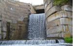
Norwegian national parks North-West Svalbard, Indre Vijdefjord, Nordenskiöld Land, Nordre Isfjord, Sassen-Bynsov Land, Sør-Spitsbergen and Forlandet, Nordenskiöld and Brosvelbryn glaciers, Adventfjord, Longyearbyen river and valley, Nordenskiöld Land peninsula (bird colonies, Western Spitsbergen), thermal springs Trol and Jotun, waterfalls of the Esker Valley, Isoyan Ornithological Reserve.
Historical
Ruins of a whaling station and a cemetery of the 17th century, abandoned mining villages of Advent City and Jorhamn (Western Spitsbergen, early 20th century), the northernmost in the world Railway(Barentsburg).
Cultural
Svalbard Museum, Svalbard International University (1993), monument to the lost expedition of S. Andre (White, 1997), Spitsbergen Aviation Museum (2008), Museum of Pomeranian culture, flora and fauna of the Arctic (Barentsburg).
Cult
Svalbard Lutheran Church (1958), chapel of the Russian Orthodox Church (Barentsburg).
Curious facts
■ Spitsbergen is named after Willem Barents on the archipelago he discovered desert island Barents and the city of Barentsburg.■ Historians claim that the Pomeranian name for the Spitsbergen archipelago - Grumant - is a distorted rendering of the name Greenland. In the Middle Ages, it was believed that Spitsbergen connected to Greenland in the north, which in those days was also called Gruland or Grutland.
■ Most high mountain archipelago - Newton, on the island of Western Spitsbergen - named after the great English scientist Isaac Newton, but no one knows why, and the documents are lost.
■ In 2006-2008. In the village of Longyearbyen, a Global Seed Vault was built in case of a global catastrophe. Construction was carried out under the leadership of the UN, but with funds from Norway. The storage facility is a tunnel at a depth of 120 m, in which the seeds of all agricultural plants in the world are collected. All countries have their own seed block here. A storage facility has been created for the occasion; asteroid impact, nuclear war or global warming. Designed for 4.5 million seed samples. The low temperature is maintained by artificial cryogenic installations and natural permafrost, because of which (and also because of the low tectonic activity) the choice fell on Spitsbergen.
■ In the village of Longyearbyen, a Norwegian language newspaper, Svalbardposten, is published every two weeks - the world's northernmost regular printed publication. Founded in 1948, the newspaper was initially a wall newspaper and posted in the miners' dormitories of the village. Mostly anecdotes and cartoons were published to brighten up the hard work of coal miners. Today it is a completely serious news publication. Less known is the fact that from 1948 to the 1990s. The newspaper "Polar Stoker" was published on the islands - the official publication of the coal miners' trade union and the Arktikugol trust. But since the publication of the newspaper in the territory under the jurisdiction of Norway was contrary to international laws, it was believed that it was published in Moscow.
■ Svalbard International University - the northernmost educational institution in the world, lectures are given on Arctic biology, Arctic geology and geophysics. The first seminar of the first year is devoted to learning how to shoot with a carbine: there are a lot of polar bears in Svalbard.
■ The village of Pyramid owes its name to the peculiar shape of the mountain, at the foot of which it is founded on the shores of Petunia and Mimer bays.
■ The northern part of the island of Western Spitsbergen is named Andre's Land - in honor of the Swedish engineer Salomon Andre.
In 1897, he and two companions tried to reach North Pole in a hot air balloon and disappeared. Traces of the lost expedition were found only in 1930.
■ One of the last soldiers of the German Third Reich to surrender after the end of World War II was a team that maintained a weather station on Bear Island. In May 1945, radio contact with them was lost, and only in September 1945, when a Norwegian whaling ship approached the island, were they able to surrender.
■ In the Thousand Islands (Tusenøyane) archipelago south of Edge Island there are actually only forty of them.
■ The only bird that lives on Spitsbergen all year round is the arctic (white) partridge; all others migrate south for the winter.
■ Svalbard has a significant number of rocks with fossilized remains of plants and animals. In 2007, Norwegian paleontologists discovered the remains of a prehistoric animal on the archipelago - a 13 m long pliosaur.
■ In the 1890s. Germany made an attempt to establish itself on Bear Island. In 1899, the Russian ambassador in Berlin protested to the German government. A Russian cruiser was sent to the island. Then Germany abandoned further attempts to take possession of Bear.
■ The lack of wood on Spitsbergen forced the Pomors to bring with them old ships that were being dismantled. It is no coincidence that in almost all residential buildings the floors were lined with shipboards.
On February 9, 1920, the Spitsbergen Treaty was signed in Paris, a document confirming Norway's sovereignty over the polar archipelago of Spitsbergen in the Arctic Ocean.
Spitsbergen includes more than a thousand small and large islands, among which the main part of the territory is occupied by large islands - Western Spitsbergen, Barents Island, Prince Charles Land, Edge Island and North-East Land. The total area of the archipelago is 62 thousand square kilometers, almost 60% of the entire territory is covered with eternal ice.
The name of the Svalbard archipelago ("sharp mountains") included in the Treaty of Paris was given by the Dutch navigator Willem Barents in 1596.
The Russian Pomors, who long before Barents mastered the path to the archipelago, called it Grumant (or Gruland). The priority of Russians in opening the archipelago was also recognized abroad. For example, in 1493, the German doctor and geographer Hieronymus Münzer wrote in a letter to the Portuguese king that a settlement of people under the authority of the Prince of Moscow lived on the island of Grulanda. On the map of the Flemish cartographer and geographer Gerard Mercator, published in 1569, seven islands called “Russian Saints” are depicted on the site of modern Spitsbergen. On the “Map of the Northern Lands,” dated from the late 16th to early 17th centuries, the islands are marked with the inscription “Russian Land.”
The actual development of the archipelago by the Russians and the recognition of this fact abroad did not prevent Barents from installing a pillar with the state emblem on one of the islands and announcing the annexation of Spitsbergen to the Netherlands. The pillar was burned by the British in 1612, declaring that the archipelago had been discovered by the Englishman Hugh Willoughby even before Barents. By renaming Spitsbergen New King James Land, the British announced the annexation of the archipelago to the possessions of the British crown. But in 1615, the Danish-Norwegian king declared Spitsbergen part of Greenland and the possession of Denmark.
In 1871, the Swedish-Norwegian government sent notes to Russia and some Western European states, announcing their intention to annex the archipelago. Russia reacted negatively to this. The subsequent exchange of notes between Russia and Sweden - Norway (in 1871 and 1872) led to the agreement of the first treaty regime of Spitsbergen (Agreement of 1872), according to which Spitsbergen was not in the exclusive possession of any state. But the 1872 agreement on Spitsbergen did not apply to Bear Island. In the 90s of the 19th century, Germany made an attempt to establish itself on Bear Island. The Russian ambassador in Berlin in July 1899 protested to the German government, and a Russian cruiser was sent to Bear Island. Germany abandoned its attempt to take possession of the island.
After coal was found on the archipelago at the beginning of the 20th century, various countries began to show interest in it - Russia, the USA, Great Britain, Norway, Holland.
In 1910, at a conference of Russia, Norway and Sweden, a draft Convention on Spitsbergen was developed, which was based on the 1872 Agreement. In 1912 and then at an international conference in 1914, the United States and Germany tried to revise the draft, but no agreement was reached with other participants on the new text. At the same time, the countries participating in the international conference agreed with the key provision of the Russian-Norwegian-Swedish project that Spitsbergen remains removed from the sphere of state sovereignty. It was only after the First World War that countries abandoned this previously agreed upon key provision. At the Paris Peace Conference on February 9, 1920, without the participation of Russia, a new legal regime for Spitsbergen was agreed upon and formalized in the form of a treaty.
According to the Treaty, which was signed by the United States, Great Britain, Norway, Denmark, France, Italy, Sweden, the Netherlands and Japan, sovereignty over the archipelago was established for Norway, but with the caveat that sovereignty is limited in nature, therefore allowing all states that signed the treaty to equally with Norway to engage in economic, scientific and research activities on the archipelago and in its territorial waters. Spitsbergen also has the status of a demilitarized zone, which does not allow the use of the archipelago for military purposes.
On August 14, 1925, Spitsbergen became part of the Kingdom of Norway. The USSR officially joined the Treaty of Paris on May 7, 1935.
The Norwegian Parliament, in a resolution dated February 15, 1947, recognized that the USSR is a state that, along with Norway, has special economic interests in Spitsbergen.
The administrative center of Svalbard (the Norwegian name for Spitsbergen) is the largest village of Longyearbyen (Longyearbyen), which was built by the Arctic Coal Co. in 1906. The village got its name in honor of the founder of this company, the American John Longyear. State administration of the archipelago is carried out by the Governor of Svalbard, who serves as head of administration, head of the police department, public notary, and also heads the emergency rescue service.
The governor reports to the Norwegian Ministry of Justice.
About 2,600 people permanently live on Svalbard (permanent residents here are those who live on the islands of the archipelago and intend to stay here for more than six months). Among them are more than 1,700 Norwegians, about 370 Ukrainians and only about 100 Russian citizens. In addition to them, about 500 people from about 40 countries live here.
Currently, industrial coal mining in Svalbard is carried out by the Norwegian company Store Norske at mines in Sveagruve, 60 kilometers south of Longyearbyen, and at mine No. 7 in Adventdalen.
Since 1931, a domestic enterprise, the Arktikugol trust, has been mining coal on the archipelago. Currently, the Arktikugol trust retains one operating mine in Barentsburg.
There is a completely visa-free regime in Spitsbergen. Official languages are Russian and Norwegian.
The offshore waters of Spitsbergen conceal large reserves of hydrocarbon raw materials. The most promising areas of the sea in this regard are located in the shelf zone, the ownership of which is disputed by Russia and Norway.
The material was prepared based on information from RIA Novosti and open sources
Spitsbergen is an island in the Arctic Ocean. It is one of the northernmost inhabited regions of the world. Despite the harsh conditions, there are seven national parks here, and tourism is actively developing. Who owns the island of Spitsbergen? Why is he interesting? Let's find out about it.
Ice Ocean Archipelago
Western Spitsbergen (often used without the word “western”) is an island within the archipelago of the same name, consisting of several large and dozens of tiny islands, skerries and individual rocky outcrops. It is home to several communities, an airport, coal mines and a world seed bank.
Where is the island of Spitsbergen? It is located 450 kilometers from the eastern coast of Greenland and approximately 650 kilometers from the north of Norway. It is washed by the waters of the Greenland and Barents Seas, and in the north by the open waters of the Arctic Ocean.
The archipelago of the same name to which it belongs is also known as Svalbard, Grumant or Spitsbergen. It includes: North-Eastern Land, Barents Island, Edge, Kongsøya, Bear Island, Svenskøya and other territories.
The archipelago covers 61,022 square kilometers. The total number of its inhabitants is less three thousand Human.
History of the island of Spitsbergen
The history of Spitsbergen is a very complicated matter. For a long time, its territory was considered a kind of international zone, a “no man's land”, where more than ten countries of the world carried out various activities. This later gave rise to disputes about its ownership, with Russia and Norway playing the main role in this “play.”
The discoverer of the island of Spitsbergen (Norway) is officially considered to be the Dutch explorer and navigator Willem Barents. He discovered it in 1596, calling it Spitsbergen (or “sharp mountains”).
Large colonies of whales and walruses lived in the coastal waters, so whalers from all nearby regions soon headed here. England and Denmark managed to claim ownership of the island, but things did not go further than statements. By the 18th century, whales in this area were almost exterminated, and interest in new territories dropped significantly.
At the end of the 19th and beginning of the 20th centuries, research expeditions began to be sent here. So, Fridtjof Nansen, Roald Amundsen, Solomon Andre, Vladimir Rusanov visited the island. The discovery of coal deposits led to the emergence of mining settlements of Norwegians, Swedes, Russians, British, etc.
Today, the country that owns the island of Spitsbergen, like the entire archipelago, is Norway. She was the first to officially lay claim to its territory and received the consent of the remaining states in 1920.
During World War II, the island's inhabitants were evacuated. It housed several German weather stations, and Norwegian troops were sent to eliminate them. After the war, coal mining was resumed by Norway and Russia.

Whose island?
Spitsbergen has repeatedly been the subject of disputes between Russia and Norway. And although all the troubles seemed to have been settled at the beginning of the 20th century, the question of who should own the island periodically comes up again.
Both countries claim that their people knew about the existence of the island long before the discovery of Barents. Norwegians report that under the name Svalbard it appeared in the Scandinavian sagas of the 10th-11th centuries. According to Russia, Russian Pomors were the first to populate it. But not a single fact has yet been sufficiently substantiated.
In 1920, the Treaty of Spitsbergen was signed in Paris, establishing the sovereignty of Norway. Now its participants are 50 countries, including Russia, the Netherlands, Poland, Hungary, the Czech Republic, etc. All of them have the right to carry out research and economic activities on it. According to the treaty, the island is a demilitarized zone - it is prohibited to build military bases on it.
In 1947, Russia's special economic interests in Spitsbergen were recognized. Currently, the main activities here are carried out only by it and Norway. Other countries only partly. There is a Russian company working on the island. mobile connection, and Russians themselves do not need a visa to visit it.
Locals
The population of the archipelago is mostly concentrated in Western Spitsbergen. It has an airport connecting the island with the cities of Oslo and Tromso. Charter flights also deliver passengers to Moscow.
The main languages on the island are Norwegian and Russian. Many local residents also speak English. Before 1995, a significantly larger number of Russian citizens lived here. Now they, together with Ukrainians, make up about 16% of the population, 70% are Norwegians. There are about 10% of Poles on the island of Spitsbergen, all of whom live at the Polish research station Horsund.

It is home to three Russian mining towns. Two of them, Grumant and Pyramid, are preserved. Only Barentsburg is residential. There are two Norwegian villages: Logjir and Sveagruva. In addition, the international base Ny-Ålesund is located on the territory of Svalbard. At different times, from 30 to 120 people live in it.
Climate
Seeing an island on the map, almost entirely marked in white, you can imagine a huge snow-covered area where eternal frost reigns. Perhaps this would be so, but the shores of Svalbard are washed by the warm North Atlantic Current. It makes average winter temperatures on the island as much as 20 degrees higher than temperatures at the same latitudes in Canada and Russia.

Thanks to the current, the shores around the archipelago are not covered with permanent ice, and navigation is possible throughout almost the entire year. Temperature in winter months usually does not fall below -20, and in summer the average is +5 degrees.
In winter, the island, like the entire archipelago, is dominated by strong winds carrying cold air. Fogs often occur in summer. Precipitation falls on it regularly, but its quantity is small.
The polar night on the island lasts 120 days a year, the polar day - 127. This is one of the places on the planet where you can observe the northern lights. There is even a special observatory on Spitsbergen to study it.
Nature
The flora of the island is diverse in its own way. Its territory is covered by tundra, which means there are almost no trees. But there are more than three hundred different mosses, about 180 vascular plants and thousands of species of algae. Red algae are also common on glaciers; they give them a special pinkish tint.
In seven local national parks Arctic foxes, deer, beluga whales, walruses, etc. live on the island. More polar bears live on the island than people, and it is quite possible to meet them. Because of this, every person is allowed to carry a weapon. At the local university, before starting practical work on the street, you must take a shooting course.

World Seed Vault
Norway has prepared for the end of the world like no other. In case of any global catastrophe, the country has built a huge bunker in which seed samples from all over the world are stored. Due to the presence of cold temperatures and weak seismic and volcanic activity the island of Spitsbergen turned out to be an ideal candidate for such a premises.
The storage facility is located in a layer of permafrost, at a depth of 120 meters. It is equipped with a sophisticated security system and blast doors. Its refrigeration chambers can run on coal, so the bank will definitely withstand a power outage.

Every country in the world has its own safe. In total, there are about 4 million samples contained in several packages. To prevent rapid aging of seeds, their storage conditions are carefully monitored.
Longyearbyen
The largest settlement on the island of Spitsbergen and its administrative center is Longyearbyen. It belongs to the Svalbard district. The community was founded in 1906 as the base of the Arctic Coal Co. from Boston. After 1916, the base was bought by the Norwegian company Store Norske.
It is located in the interior of the island, on the southern coast of Adventfjord. The town is crossed by the Longyearbyen River, which periodically dries up.

Longyearbyen is home to a major seaport, as well as the University of Svalbard, a branch of the Norwegian Polar Institute. This is the main cultural and tourist center of the island. The main attractions here are the 1921 church, the gallery and the Svalbard Museum, where you can learn about the full history of the island, as well as its natural features. A common activity here is kayaking among the ice floes.
Barentsburg
Where else in Norway can you see Lenin? Of course, in Russian villages Spitsbergen. In Barentsburg, the monument is located next to the consulate building. Behind him on the slope you can see the inscription “Peace to the World”, and right behind it - “Our goal is communism!”, They have been untouched since the days of the Union.

The city is located on the same coast as Longyearbyen, only to the west. Its permanent population does not exceed 500 people, many came here from Donbass. There is a hospital, school, sports center, kindergarten and shops, as well as a coal-fired power plant and a mine. The mine of the Arktigugol trust is considered an unprofitable enterprise, because the extracted resource is only enough to service Barentsburg.
“Real” money practically does not circulate in the city; they are used to pay only in souvenir shops. All residents have special cards on which all expenses are credited and then deducted from their salaries. Although regular credit cards also work here.
The island of Spitsbergen remains for most Russians a kind of “terra incognita” - an unexplored land. Some people even find it difficult to answer the question about the nationality of this territory. Most people only know that Spitsbergen is located somewhere far in the north, beyond the Arctic Circle, and the Russian Federation has some kind of right to it.
Is it worth comparing this island with the Kuril Islands? We will clarify this issue below. Despite its location “almost at the North Pole,” travel to Spitsbergen is quite popular. We will tell you in this article about when to go to the polar piece of land, where to stay and what to see.
Where is the island of Spitsbergen
Let's start with a small correction. The fact is that the definition of “island” in relation to Spitsbergen will be incorrect. This is an archipelago. It lies only an hour and a half flight from the North Pole. Therefore, the typical landscape is an endless snowy desert, permafrost, polar bears.
Archipelago, with total area sixty-one thousand square kilometers, consists of three large islands, seven small and large number very small. Only the largest, Western Spitsbergen (37,673 km 2), is truly inhabited. There is the only airport and the capital of the region, the city of Longyearbyen.
In addition to it, in Western Spitsbergen there are the following villages: Barentsburg, Ny-Ålesund, Grumant and Pyramid. The last two are now deserted. On other islands (North-Eastern Land, Edge, Barents, White, Kongsøya, Wilhelma, Svenskøya) no more than a dozen people live, and even then only in the summer. The population of the entire archipelago does not exceed three thousand people.

Climate
The island of Spitsbergen lies in the Arctic Ocean between 76 and 80 degrees north latitude and 10°-32° east longitude. However, this location does not mean that the archipelago is a complete Arctic desert. Thanks to the Spitsberg Current (a branch of the Gulf Stream), the sea near the coast never freezes. The climate on the archipelago is not as harsh as in other places at the same latitudes. For example, the average air temperature here in January is only 11-15 degrees below zero. In July, the thermometer rises only to +6 °C.
There are two tourist seasons here: from March to May, lovers of winter fun and those who want to experience the harsh polar winter come. They ride snowmobiles and admire northern lights. From June to August, a completely different crowd visits the archipelago. Tourists enjoy kayaking among icebergs and watching polar bears. There are also those who consider this archipelago as a transit point on the way to conquering the North Pole.

Nature
Since Barents described seeing a huge number of whales in the local waters, many fishing vessels rushed to the shores. Soon Denmark and Great Britain began to make their claims to the islands. In the 60s of the eighteenth century, two scientific expeditions organized by M. Lomonosov visited here.
Despite the fact that the Russians did not build a single village here, some Pomors came here in the summer to fish. When there were critically few animals left on the archipelago, the islands were abandoned for a hundred years. A new surge of interest in Spitsbergen arose at the turn of the 19th-20th centuries, when humanity set out to reach the North Pole. The ice-free waters and relatively mild climate of the island were used by Arctic expeditions. Spitsbergen became the main departure base.

Spitsbergen Island: who owns it?
When powerful coal deposits were discovered on the archipelago, interest in the islands lost beyond the Arctic Circle intensified again. But in 1920, the issue of state ownership of the lands was finally resolved peacefully. The so-called Spitsbergen Treaty was signed in Paris, according to which the archipelago came under the sovereignty of Norway. However, according to this agreement, all parties to the treaty (Great Britain, USA, France, Japan, Sweden, Italy, the Netherlands and later the USSR) retained the right to develop mineral resources.
Do you need a visa to visit the archipelago?
Theoretically, no. After all, it doesn’t matter whose island Svalbard is, citizens of all of the above signatory countries can freely visit the archipelago. However, in practice, getting to Spitsbergen directly from Russia is not so easy. Only during the season, charter flights occasionally go there, and seats on planes are reserved for polar explorers or government employees. Therefore, tourists are forced to fly through Oslo (by SAS and Norwegian Airlines). And this requires a multiple-entry Schengen visa to enter Norway. You can also visit the archipelago during a luxury cruise on the ocean liner Captain Khlebnikov.

Tourism
The Norwegian authorities very quickly reoriented the economy of the archipelago in the face of a decrease in the number of whales and polar bears and falling coal prices. Now the main focus is on ecotourism. The direction is new. So far, only two thousand tourists visit the cold islands annually. Prices are also not conducive to the development of this industry. Everything is expensive here: from a hotel room (the simplest economy option will cost one hundred dollars per night) to food. However, this does not stop rich tourists. Climbing to glaciers, sea rafting, horse riding dog sledding, collecting fossils (there are a lot of them on the archipelago) - all this is included in the mandatory program.
The islands are a duty-free trade zone. Thanks to her, the population of the archipelago lives more prosperously than the Norwegians on the continent. The island of Spitsbergen is protected from migrant workers. Work at many mines has ceased and they have been converted into museums. Only Russian miners do not stop producing coal. Although this production is unprofitable and is subsidized by the state.
Money scandal
In 1993, the Moscow Court minted a commemorative coin “Spitsbergen Island”. It showed a polar bear and a map of the archipelago. Since the money had the inscription “Russian Federation” on it, Norway perceived this as an encroachment on its territory. The diplomatic scandal was settled only when the money was withdrawn from circulation. Those left on hand are in high demand.