Peak topographers Eastern Sayan on the map. Topographers Peak. Geographical features of the Eastern Sayans
Military Topographers Peak with ice. Yu. Inylchek (from the confluence with the ice. Torn). To the left is Pogrebetsky Peak and its northern wall (climbed only in 2006). The ridge to the right against the sky - to the Chonteren pass, from which the route to peak 5A to tr. And the snowy saddle in front of the peak, against the backdrop of the ridge to Chonteren, is the Vysoky Pass. Yes, the Chonteren pass leads the follower Zvezdochka onto the ice. Chonteren (China), and Vysoky - from the headwaters of the Yu. Inylchek glacier onto the ice. Star.
Studying the materials that I managed to find on the Internet, I got the impression that the peak does not belong to the category of frequently visited objects. Judge for yourself: the first attempt to climb to the top was made in the expedition of Igor Erokhin in 1958. From the Chonteren pass. But then, in fact, they did not set a goal to climb, since Victory was their main goal, but they climbed for acclimatization. And if we rely on the book “Victory of Igor Erokhin,” as soon as the movement became more complicated, they turned back. The place where we climbed was called the peak of Military Topographers W., 6816 m. Actually, at this point the ridges from the Chonteren and Vysoky passes converge (although it seemed to me visually that they converged a little earlier). Finally, in 1965, an expedition appeared here, planning to make the first ascent of the peak. The ascent of the pioneers is described, for example, here: http://refdb.ru/look/1517800-pall.html. They entered the area at the beginning of July, already with acclimatization, and by July 29 they reached the upper reaches of the South Inylchek. The ascent took place, in fact, in the Himalayan style - with the installation of 3 intermediate camps (the 3rd - at the Vysoky pass). On August 5, after a rest, they started from the lower camp, on the 8th they climbed the Vysoky pass (5964 m), on August 14 they climbed the western peak - they took down Igor Erokhin’s note. On August 15 we were at the top and descended in 3 days. The route is classified 5B k.tr. And again, at least according to my information, it was no longer passed. Next we read on the website of Kazbek Valiev - they (Valera Khrischaty and Kazbek) took the note from the first climbers in 1988, when as part of the Union team they made the Pobeda - Military Topographers traverse (preparing for Kancha).
View of Topographers from the western saddle of Khan Tengri. There are different ways to go through the icefall. This is an icefall, which for some reason is called the second by first climbers. But I didn’t notice it below the icefall. Blue - that’s how we passed it in 1993. Red - approximately the path of the first climbers. I came across descriptions with other options. Well, this is clearly a matter of taste and condition. These are all the routes taken by Military topographers from the north (from Kyrgyzstan). I didn’t find Korenev’s description, but I assume that’s how they climbed in. But if I'm wrong, maybe someone will correct me.
The next to the top were Valera Khrishchaty and his team on the Pobeda-Khan-Tengri traverse in 1990. Whether anyone went there in the 90s, I just don’t know, again, maybe someone will add something. But there is a suspicion that we could be there next in 2001 - then we were planning a traverse from the Chonteren Pass. But, fortunately, nothing came of it - that is, it turned out to be “breakfast with a view of Elbrus.” True, we didn’t have breakfast and we didn’t see anything - we only heard... In bad weather we made our way along Zvezdochka near Chonteren, hoping that when we approached the weather would just get better, we sat there for two days with visibility... In general, a shovel It was hard to see in front of the vestibule of the tent... Well, we heard avalanches from all sides... And sometimes we felt when it was getting hit by a shock wave. So in the end they crawled back. Why "fortunately"? Well, I don’t like to climb one peak several times. And since 2002, the Chinese Tien Shan opened up to us - and we saw it from there... Yes, I immediately forgot about the traverse.
In general, our route from China is the fourth line to the summit. Or the fifth, if you count the traverse. And we took notes from there from Korenev for 2003 and Kirikov (Tomsk) for 2005 (Kirikov did not find Korenev’s note - there were two rounds there). This is the easiest route from the south and the most difficult one climbed to this peak.
Yes, also - Military Topographers Peak 6873 - the third highest peak of the Tien Shan.
At first we planned to start directly from the foot of our southern edge, i.e. from a height of 4000 m. There, before reaching the flat part of the ridge, there is a good “Crimean” five, Vovka and I even felt it during reconnaissance. But then they decided to shorten the length of the difficult part a little, and bypass this “five” through the eastern side circus. And thank God - after the “five” there turned out to be such a sophisticated ridge that there was a chance to get out along it for a couple of days only to our exit point.
And we descend into a rock-dangerous couloir, run to the shelter - under the cornice, and walk along the cornice, bypassing the remaining faults...
And soon we descend onto the Chonteren glacier - into our native icefall, through which we walked in 2002. And this means that we are at the bottom.
A couple more hours and we are at the base. The process of completing our expedition begins - mothballing the base. Until next time... Ahead is an easy (2A) pass and a 40-50 km race. Trouble awaited us here too. To begin with, Kolya got sick on a moraine, so much so that... Well, his knee is swollen, his face is slightly bruised, but he seems to be able to walk. And that’s good... Apparently, with the total volume of loads we are already overkill.
In 1988, on the initiative of employees of TsNIIGAiK S.V. Novikova, V.B. Obinyakov and A.I. Razumovsky organized a thematic sports expedition dedicated to the 70th anniversary of the formation of the USSR Geodetic Service.
In honor of the surveyors and topographers who created the map of the USSR, it was proposed to install a memorial sign in the form of a stylized geodetic pyramid on the mountain peak of Topographers Peak (Eastern Sayan). The board of the USSR Main Civil Code supported and approved the initiative.
The area of Topographers Peak in the southern part of the Eastern Sayan was at that time one of the most interesting tourist areas, annually visited by mountain, hiking and water tourists from all over the country.

During preparations for the expedition, unfortunately, it was not possible to establish when, by whom and in connection with what this peak was named. No materials about Topographers Peak were found in organizations that carried out topographic and geodetic work in this area in the 50s. Veterans - surveyors and topographers who worked in those years in Eastern Sayan. Presumably the peak received its name in the 50s when deciphering aerial photographs.

When reading cartographic materials and tourist reports in the area of Topographers Peak, a suspicion arose, later confirmed on the spot, that numerous tourist groups that had climbed Topographers Peak over the past 30 years were actually climbing an unnamed trapezoidal peak that dominates the area. region. The Topographers Peak itself is located 750 m to the southeast of this peak and its height is 74 m less than the height of the unnamed peak. And it is quite natural that tourists began to mistake the dominant peak in the region for Topographers Peak. It should also be noted that the height of the unnamed peak is 3089 m, and the real Topographers Peak is 3015 m.

Taking into account the clarified circumstances, it was decided to install a memorial geodetic sign on an unnamed trapezoidal peak, visited by tourists and included in the classification list, category 2a.
Under the leadership of S. V. Novikov, the design and technical specifications for the production of the memorial sign were developed. The sign itself was made at the Experimental Optical-Mechanical Plant of the State University of Civil Engineering of the USSR. The sign was collapsible and looked like a stylized triangular pyramid with a globe at the base. Technical assistance in conducting the expedition was provided by the Irkutsk Aerogeodetic Enterprise.
The expedition included 20 people - employees of TsNIIGAiK, State Center "Nature", PKO "Cartography", Moscow and Irkutsk Aerogeodetic Enterprises and other organizations.
In the last days of July 1988, a helicopter dropped the expedition members into the upper reaches of the Khelgin River, from where tourist groups usually climb. The first days of the expedition's stay at the source of Khelgin fully confirmed the information about the extreme instability of the weather in this area. The pouring rain gave way to fog, the fog gave way to snow, then it cleared up for a while and then it all happened again.
The ascent and delivery of cargo to the summit was led by TsNIIGAiK researcher, master of sports in mountaineering A. A. Lozovsky. The abundance of snow in the mountains, avalanches and the weight of the load made the ascent a completely unsportsmanlike event. Shuttle flights managed to lift the load onto the glacier, and on the first sunny day, July 30, a chain of people stretched up the glacier to the top.

The enthusiasm of the participants and good weather helped not only to lift up the entire cargo (which included disassembled memorial sign, cement, tools, boards, buckets, etc.), but also to install a memorial geodetic sign at the top.
The inscriptions are engraved on the edges of the sign: “TO GEODESISTS, TOPOGRAPHERS and CARTOGRAPHERS-CREATORS OF THE USSR MAP. On March 15, 1919, V. I. Lenin signed a decree on the organization of the country’s topographic, geodetic and cartographic service. TOPOGRAPHERS PEAK ARRAY. HEIGHT 3089 m.”

A few days later the weather allowed us to climb to the top again and take photographs and films. However, by coincidence, none of the shots with Topographers Peak turned out.

With regret, the expedition members parted with this harsh but beautiful region of the Eastern Sayan. Ahead lay a rafting trip on catamarans along the Tissa and Oka rivers, 300 km long to the village of Maslyanogorsk. To carry out safe rafting on rivers with dangerous rapids, the expedition was divided into two groups, which were led by experienced water tourists - employees of TsNIIGAiK S.V. Novikov and A.I. Razumovsky.

In the second half of the 19th century, the routes of topographers and surveyors of the Military Topographical Department of the General Staff passed along these rivers. The Tissa River valley was first visited in 1834 by members of the expedition of the Irkutsk botanist N. S. Turchaninov, and the Cossack Kuznetsov was sent to this area to collect plants and describe the area.
At the end of the 1850s, the route of topographer I. S. Kryzhin, a participant in the Great Siberian Expedition of the Russian Geographical Society, passed through the Oka River valley. country, and, moreover, a route that can be well mapped with the help of fairly accurate astronomical determinations of the positions of places.” Based on the materials of this expedition, a map of Eastern Siberia was published in 1861, which became the best card that time. In 1865 along the river. Oka passed the route of P. A. Kropotkin, subsequently famous geographer and a revolutionary who rode on horseback from the village of Tunka to the village of Ziminsky (now the village of Zima) and made a number of geographical and ethnographic discoveries in this area. It is interesting that P. A. Kropotkin was going to go by boat across the many kilometers of the Oka cheeks, now known as the Orkha-Bom gorge. And only the high price demanded by local hunters who agreed to go by boat did not allow the future world-famous anarchist to try his fate on the dangerous rapids of the Sayan River.
In 1887, the routes of surveyor Schmidt and geologist Yachevsky, members of the expedition of Lieutenant Colonel of the General Staff N. P. Bobyr, organized by the Governor-General of Eastern Siberia with the aim of exploring the southern space of the Irkutsk province, passed along the Tissa. The results of these and subsequent expeditions marked the beginning of the development of this region of Eastern Siberia.

After the establishment of Soviet power, surveyors and topographers of the country's geodetic service continued research in this area. In the 1930s, the Geodetic Service was tasked with creating a map of a scale of 1:1,000,000 for the entire territory of the state. Completion of mapping the country by the early 1950s required heroic efforts from surveyors, topographers and cartographers, which can hardly be fully assessed now possible. This is described in the books of the geodesist-writer G. A. Fedoseev, whose geodetic expedition routes also passed through the Eastern Sayan.
Surveyors, topographers and cartographers - the creators of the map of our country deserve a blessed memory, and the memorial geodetic sign on the top of the Eastern Sayan reminds of this to everyone who was able to climb to the top.

Oka port – village. Khandyto (non-residential), 8 km, net running time 1 hour 50 min. Clear, temperature +18 degrees.
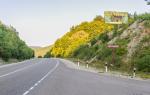
The path goes along a good dirt road.
With. Khandyto - pilot Khutel, 16 km, net running time 4 hours 30 minutes. Cloudy, temperature +12 degrees, wind, rain.
summerhouse Khutel – mineral spring Halun, 14 km, net running time 4 hours 35 minutes. Cloudy, t +10 degrees, rain.
From the Khutel summer camp our route lay up the river. Sentsa to the mouth of Burun-Kadir-Osa, and then along this river to the Valley of the Volcanoes. From the summer house the road goes through a lowland and is very dirty (cattle are being driven), and from the Bulunai summer house there is a horse trail.
Highway passes along Sentsa. When crossing Burun-Kadir-Os, we had to use the main rope for insurance. The further path passes either along a horse trail or along a road.
mineral spring Khalun – mineral spring Khoito-Gol, 14 km, net running time 3 hours 20 minutes. Clear, t +20 degrees.
There is a road again from the Halun mineral spring to Khoito-Gol, but in some places it is better to follow the horse trail, since it is denser and there is no dirt on it even during rain. In the area where the river confluences. Bushtyg to Sentsa often requires a ford. The depth is small, but depends on the water level in these rivers. The road is built around this area, along the top. When approaching the Khoito-Gol spring there are also two fords across the river. Arshan.
mineral spring Khoito-Gol – Valley of the Volcanoes – river. Burun-Kadir-Os, 30 km, net running time 7 hours 10 minutes. Clear, t + 20 degrees.
There is a clearly defined path from the source to the pass, which is easy to navigate. At the pass itself (the flat shoulder of the nearest peak), the trail is lost, and you need to move, guided by the tours, and if the weather is sunny, then go straight into the sun (first half of the day). Beyond the pass there is a short descent through the snowfields to the lake. There is a path to the lake, but in some places it is not visible, and you need to navigate by following the tours. To Burun-Kadir-Osa, the trail winds through thickets of dwarf birch, then along the stream. You need to be careful, because between the dense thickets there are no holes filled with water.
To the Peretolchina volcano the trail goes along the edge of the left field. The volcano itself is a regular truncated cone, overgrown with grass and larch. In the crater of a volcano in the center of a small lake there is a complex tour.
From Peretolchin Volcano to Kropotkin Volcano there is a trail that crosses the lava field and then follows its edge. From both volcanoes the entire lava field is clearly visible, and the surrounding mountains give the area a picturesque appearance.
It is better to organize a parking lot at the Peretolchina volcano, since there is firewood and water nearby.
R. Burun-Kadir-Os – mineral spring Khoyto-Gol, 31 km, net running time 9 hours 20 minutes. Clear, t +25 degrees.
The trail along Burun-Kadir-Os is clearly defined at first, but then after 4 km it disappears into the dwarf birch forest, which is very difficult to move along. Sometimes there are animal trails, but they are very short. You have to walk along one bank, then the other, sometimes even along the river itself.
In the upper reaches of the river the valley is wide, and there are aufeis (ice thickness up to 1.5 m). Then the sides of the valley narrow, the path moves away from the river by 300-500 meters. Where Burun-Kadir-Os turns east (already flows along the Sentsa valley), there are many trails. The further path to the Khoito-Gol mineral spring follows an already well-known road.
mineral spring Khoyto-Gol - lake Zagan-Nur, 13 km, net running time 3 hours 15 minutes. Clear t +25 degrees.
There is a well-known path to Three Rivers, where the Senza originates. Then you need to climb up Dunda-Gol. The trail is very good. The only obstacle on this trail is fords: three across Dunda-Gol and one across the Khoito-Gol stream. All the way to the lake, the trail winds along old moraine ridges past small lakes.
There are permanent parking areas on the shore. There are a lot of grayling in the lake.
Lake Zagan-Nur - lane. Choygan-Daban – Choygan mineral spring, 12 km, net running time 4 hours 15 minutes. The weather is cloudy, sometimes rain and snow, strong wind, t +4 - +6 degrees.
The trail to the source itself is very good. Slight difficulty in orientation when approaching the pass. You can't go left or right. You need to stick to the middle direction, focusing on the right slope of the mountain (in the direction of travel). The trail then reaches the watershed plateau. In the wet season it is swampy. After passing two lakes, we descend into the valley to Choygan, famous for its hot radon springs. The descent is steep and you need to be careful not to trip over the protruding roots.
In total, Choigan has 33 springs with different water temperatures.
Day. Clear, t +15 degrees. Radial access to the waterfalls. Covered 18 km in 6 hours.
mineral spring Choygan – per. Khelgin - the right source of the river. Helgin, 12 km, net running time 3 hours 50 minutes. Clear, t +15-18 degrees.
Today we begin our approaches to Topographers Peak. At first, the trail winds through the forest among windbreaks, then begins the ascent to the first terrace. There is a small lake at the top. Further along the Arzhan-Khem stream, and take off again. From stone to stone we go out onto a small plateau, go around the first big lake(it remains to the right), and again a cascade of takeoffs. Second big lake. Partially it is still under the ice. There are many snowfields around it. We overcome them and go to the pass point - the tour. Descent along a rather steep snowfield. We slide down like on skis and find ourselves in the kingdom of frying. We walk a little along the swampy plain to a huge boulder. Below you can see Lake Dede-Khukhe-Nur, a little to the left and closer to us from under the Old Man Mountain the Left Khelgin flows, cascading down as a small waterfall.
When parking, it is better to stand next to this boulder. The most convenient route to the top begins from here, and the place is flat and dry. There is no firewood in the area of Topographers Peak.
Climbing Topographers Peak – Lake Dooda-Khukhe-Nur, 17 km, net running time 7 hours. Cloudy, but high cloud cover, about 3500 m, t +5 degrees. From the second half of the day it is clear, t +15 degrees.
The most convenient way to climb the topographers’ peak is from the boulder, right behind the stream. The climb is steep but short. Further up to the peak there is a snowfield, which consists of two steps. The box in which he lies is large and wide. On the left rises a beautiful peak, on the right there is a wall that also turns into a peak, straight ahead there is the trapezoidal peak of Topographers Peak.
At the very base of the peak we turn left and climb along the stones to the edge. Next - firn. We climb it under the rocks, a little more rock climbing, and we are at the top. When climbing, you need to have a couple of 30-40 m ropes, ice axes and crampons for the first participant. There are snow caps hanging at the very top, so you need to be careful in case of an avalanche. The peak itself is a truncated cone with a flat top, on which there are two tours. The descent began from the left tour along the stones, and then along the snowfield. We went down like on skis. The path to Lake Dooda-Khukhe-Nur is quite difficult - kurumniks along the lake, lack of trails, swampy terrain - all this creates inconveniences that we cannot live without. It is more convenient to walk past Lake Dede on the right side. The lake itself was formed as a result of the destruction of rocks. The water in it is clean, but there are no fish.
Lake Dooda-Khukhe-Nur – r. Shara-Tyrendita, 15 km, net running time 4 hours 45 minutes. Clear, t +29 degrees.
The path appears about 2 kilometers before the lake, and along the lake itself you have to walk along the kurumnik again. The history of formation of Dood is similar to Dede, but it is smaller.
Before the confluence of the Khelgin and the Tissa, the trail is clearly defined, there are no special obstacles on it. There are often sites for shepherds and tourists. Particularly popular is parking at the mouth and above the waterfall - large grayling are caught. The further path is down the Tissa to the mouth of the river. Shara-Tyrendity - passes through the lowland among thickets of bushes. There is a good parking area right next to the river.
R. Shara-Tyrendita - Lake Alek-Nur, 23 km, net running time 7 hours. Cloudy, rainy at times, t +5 degrees. In the second half of the day it will be lightly cloudy, t +10-15 degrees.
From the parking lot to the first clamp - 1.5 km. The pressure is difficult to overcome only in deep water. Further, the trail departs from the river, in some places for more than a kilometer, hiding in the forest, which makes it difficult to determine the location of the group. The river stands as a serious obstacle on the way. Shuthulai. It is especially dangerous in rainy weather. The river quickly carries its waters into the Tissa, spilling into three branches before its confluence. Even in low water, crossing the main branch is difficult and requires insurance. Its width is about 50 m. Further, the path goes out onto a terrace, overgrown in places with small bushes.
On the approaches to Lake Shuthu-Lai-Nur, the trail gradually begins to climb upward, going to the Mukhai-Khutel-Aaban pass. Shepherds use this route, driving their herds to summer pastures in the upper reaches of the Tisza.
Lake Alek-Nur - r. Dabata, 28 km, net running time 6 hours 40 minutes. Clear, t +18 degrees. In the evening there is a slight thunderstorm.
The road to Balakta begins from the lake. The pressure near the mouth of Dabata is waded in low water, but in high water it is better to go around it on top.
R. Dabata - village Balakta, 14 km, net running time 3 hours 15 minutes.
From the mouth of the Dabata, the trail is again a horse trail, since cars are transported to the other bank of the Tisza above the pressure. The road starts only from the Bukhem-Khebtete winter road. To the village Orlik can be reached from here by hitchhiking.
Southern Siberia can rightfully be considered the pride of Russian tourism. It was here that mountain peaks, forests, glaciers, taiga, and meadows were uniquely combined. One of the most significant attractions of the region is the Eastern Sayan Mountains and Topographers Peak, the highest glacier in the mountain system.
Geographical features of the Eastern Sayans
Topographers Peak is a glacier 3089 m high, part of the Charm-Taiga massif and located among the Eastern Sayan Mountains in southern Siberia. Length mountain peaks more than a kilometer in length, from the Yenisei to Lake Baikal. Their structure includes volcanic plateaus, white mountains, flat peaks, and high mountain ranges. Ridges with varied topography and minerals are scattered over a vast territory, which occupies the following areas:
- Buryatia;
- Krasnoyarsk Territory;
- Irkutsk region;
- Mongolia;
- Tuva.
Among the natural objects of the mountains around Topographers Peak you can find canyons, basins, glaciers, lava flows, waterfalls, and lakes of glacial origin. The vegetation is dominated by forests - cedar, spruce, fir, deciduous - as well as tundra and meadow shrubs.
INTERESTING ! On the territory of the Sayan Mountains there are the Stolby and Tunkinsky nature reserves. national park, where you can visit mineral springs.


Coordinates: 52°29"32"N 98°49"6"E
Climbing Topographers Peak and main points
Climbing to the top of Topographers is a challenging but exciting experience. Not everyone can overcome almost 3.1 km in height on the snow surface. The peak itself consists of two peaks on one plateau - left and right, or northern and southern. All possible benefits of civilization are located on the southern part - there are tours, signs, water, and recreation areas.
Topographers Peak is clearly visible from many places, and they are also the main points of the glacier:
- Sherpov, Khelgin, Cherbi, Nevidimki, Pyatiozerny, Hanging, Shutkhulai passes;
- the upper reaches of the rivers Tissa, Kok-Khem, Uzun-Uzyu, Burun-Sala, Arzhan-Khem;
- the mouth of the Zhombolok River;
- northeastern side of the Khi-Gol valley;
- plateau between Senza and Tissa;
- Dargyl river, past the Khoito-Gol spring.
Topographers Peak can be seen even from Choygan Peak, the Bolshoy Sayan Ridge, as well as from the Valley of Volcanoes.
Most tourists climb the peak towards the upper right edge, through the left saddle or along the central part of the glacier. According to the international classification, climbing Topographers Peak has a difficulty category of UIAA 2+ - 1+ is considered the most difficult and dangerous level.


What to take with you on a hike
Not a single trip to the mountains is complete without the appropriate equipment, inventory, and provisions. Food products should include drinking water, as well as canned food and other shelf-stable foods. Don't forget about the first aid kit.
Personal equipment includes:
- Hygiene supplies;
- Warm clothes, thermal underwear;
- Waterproof outerwear;
- Comfortable warm shoes;
- Backpack, tent, sleeping bag, rug;
- Mountaineering equipment.
Additionally, you must have a tent for the fire, an ax, a 50-60 m rope, a flashlight, steel or aluminum ropes, maps, and a GPS navigator. It is advisable to take trekking poles and a burner for cooking. You can take a camera or video camera.


The most convenient routes
You can choose your own hiking route using maps, or choose a proven one. There are many routes on the network that are suitable for both experienced travelers and novice tourists. We offer a selection of the safest and most exciting routes to Topographers Peak:
- Khutel village - r. Dunda-Gol - trans. Choygan-Dabal - r. Arzhan-Khem - lake. Dodo-Khuhe-Nur - trans. Shuthulai - trans. Darlyg - Arshan - Senza - Khalun-Ukhan springs;
- Hadarus river - lane Choygan-Dabal - Choygan spring - Khelgin river - Burun-Sala - r. Daba-Zhalga - lake. Boldoktoy-Nur - Khoyto-Gol - lane. Amazing - Arshan - Khutel village;
- Khandyto village - ist. Khalun - Khoyto-Gol - Volcano Valley - r. Burun-Kadir-Os - lake Zagan-Nur - Dodo-Khukhe-Nur - lake. Alek-Nur - Balakta village;
- Khoito-Gol - Dargyl River - lane. Kozliny - Topographers Peak - Khelgin Pass - Choigan Peak - Arzhan-Khem - Dunda-Gol.


Weather and climate
Diversity climatic conditions mountain range due to its location at different latitudes. The climate features of Buryatia, Mongolia, Siberia, and Tuva are present here. The Eastern Sayan has a permafrost zone in the west, sunny meadows and valleys in the southwest, stable weather with minimal precipitation in the east, except for Topographers Peak.
Weather by season:
- Spring is cold, snowy, average air temperature is 0...+3°C;
- Summer is fresh, cool, rainy, air temperature stays at +19...+23°C;
- Autumn is warm, clear, practically without precipitation, air temperature fluctuates between +10...+3°С;
- Winter is cold, dry, windless, frosty, temperatures reach -40...-44°C.
CAREFULLY ! The harsh continental climate contributes to temperature differences ranging from 50-54 degrees.
When is the best time to go to Topographers Peak?
The hottest months in Buryatia are July and August, but in July, thanks to the rains, the weather is fresher. In August the season begins and crowds of tourists attack the area. The coldest months are December, January and February, the average temperature here is -22...-26°C. At the same time, February is much milder due to the accumulated snow layer.
It is best to go to the Eastern Sayan to Topographers Peak in summer or winter, when the weather is finally formed for its season. In spring, melt water and snow falls are very dangerous due to warming.
Tips for tourists before the trip:
- In order not to waste time searching for a carrier in the surrounding area, you can find in advance the contacts of transport companies or private owners of Irkutsk, Orlik;
- Beginners should avoid visiting the Hadarus River - there is a ford here, but there are also great depth;
- If the purpose of the trip is to review the landscapes, you can exclude the Khara-Saldyk and Ara-Shutkhulai rivers from the route.
Hiking in the mountains was in demand several decades ago, after which it was replaced seaside resorts. Now tourists are resuming the good old tradition of climbing. Topographers Peak is a great place that can provide impressions, adrenaline and vivid photographs.
The day of July 22 will remain in our memory for a long time. It was today, for the first time in its multi-million-year existence, that Topographers Peak was taken. Even the night before it became clear. In the black sky, as always, in the mountains, stars poured out. It became clear that the weather had decided to give us a good day. At half past six in the morning the duty officers got up, and half an hour later everyone else got up. The preparations did not take long. It’s unpleasant to walk - the rocks crumble under your feet and hands. Again rocks, scree and, most unpleasantly, loose debris. You touch a stone, which, it seems, would serve as a reliable hold, but it goes down. And so, clearing the way, moving from ledge to ledge, crossing couloirs one at a time, we finally got out onto the snowfield.
From there we got a good look at the wolverine running along the glacier - a surprisingly nasty animal. We climbed along the snowfield to the ridge separating both glaciers. It is difficult to clearly imagine the path to the top; the path along the ridge seemed optimal. It is difficult to clearly imagine the path to the top; in any case, the path along the ridge seemed optimal. First we walk along the glacier. The sun was burning with all its might, the snow was wet, deep and dense. Along it we quickly reached the opposite ridge, the snowfield of which was dotted here and there with huge stone slabs, above which we climbed up the snowfield again. This part is made of monolithic, pure granite, chopped by nature into such huge pieces that it is difficult to compare with anything.
Where we jumped from stone to stone, where we clung to the roughness and cracks of the stones and climbed to the ridge, from where a narrow valley opened up before us from edge to edge, filled with glacier and icefall, in some places smoothly flowing, in others broken, with wide cracks. On the left bank of the valley, the icefall was a stunning emerald color. The ridge on which we stood ended in a wall at a negative angle into the valley, which served as a cornice for us, and the peak itself went into this valley in completely vertical columns of some kind of shale rock, here and there blackened by the water flowing from the top.
 Our path goes along the ridge itself. Two steps to the side and it could all be over. To the left is an abyss, to the right is a steep glacier that carries the stones we have thrown onto sharp rocks. We walk very carefully: under our feet there are huge granite monoliths, on which there is nothing to grab onto. From these slabs we go out into the snow. Here, finally, is a more or less flat platform hanging over a four-hundred-meter abyss.
The impression is enhanced by the crack that separates this area from the massif. If the crack grows another four meters, our platform will fly down with a roar and whistle. The pre-summit ridge is made of huge stone blocks, we climb along them and - in front of us is the peak, an area six by fifty meters, the far edges of which are somewhat raised. Two stone beams, like two teeth, stick out vertically to a height of about two meters. There is no tour on or around them. So we are the first...
Only goats can challenge our first ascent, fortunately, while climbing to the top, we saw one of them on the pre-summit ridge.
 Using the old-fashioned method (a hole is cut in the rocket cartridge right next to the primer, matches are tied to the rocket so that they form a chain of heads running from the middle of the rocket to the hole, the outermost match is raised, and the fire, walking along the heads of the matches, should ignite the gunpowder) rocket. After much work, only Volodya Vedernikov succeeded. The rest put together a round, in which a note is inserted.
On the low edge of the plateau we lay down another round. From the top very good review. Mighty mountains crowd all around, and the outlines of Munku-Sardyk and Munku-Sasaan can be seen in the southeast. In the south, the sky is darker, filled with leaden darkness: there is a thunderstorm. We have to leave, the descent begins, which is not easier, but harder and more responsible than the ascent.
...The assault on the summit took a total of four hours and five minutes.