The round lake is fresh or salty. Lakes with unique salinity. Types of lakes by location
Let's remember: What sources feed the lakes? What is evaporation? Keywords:feeding lakes, drainage and drainage lakes, fresh and salt lakes.
1. Drainage and drainage lakes. The lakes are fed by river and underground runoff and precipitation. Depending on the water flow, lakes can be drained or drainless. Lakes that have river flow, that is, from which rivers flow, are S t o t e s lakes, and lakes that have no flow - wasteless. Drainage lakes are located mainly in areas of excess moisture, while drainage lakes are located in areas of insufficient moisture.
The level of lakes does not remain constant due to the inflow and outflow of water, it changes. Particularly large fluctuations in lake levels are observed in arid and dry areas. This is associated with changes in the areas of lakes.
** During the rainy season of wet years, the Australian Lake Eyre North is a large body of water with an area of up to 9,300 km 2, and during the dry seasons of dry years, water is stored only in a few bays of the southern part of the lake.
Fresh and salt lakes. Based on the amount of dissolved substances, lakes are divided into fresh (salt content less than 1 g per liter of water), salty (from 1 to 24 g of salts per liter) and salty , or MINERAL
(salt content more than 24 g per liter of water). In lakes with high salinity, salts precipitate. Usually wastewater lakes are fresh, since the water in them is constantly renewed. Endorheic lakes are most often brackish or saline. This happens because the water flow of such lakes is dominated by evaporation. All minerals brought by rivers and groundwater remain and accumulate in the reservoir.
**One of the largest salt lakes on Earth is the Great Salt Lake in North America (salinity from 137 to 300 0/00) (Fig. 131). The saltiest lake in the world is the Dead Sea - maximum salinity is 310 ppm.
1. What types of lakes are there in terms of water flow and salinity? 2. Why is the water in endorheic lakes most often brackish or salty 3. Name the most big lake your area. How is it used by the local population?
Practical work.
Divide these lakes into two groups (drainage and non-drainage): Baikal, Caspian Sea, Ladoga, Onega, Victoria, Tanganyika, Aral Sea, Chad, Air North.
Draw a drainage and a drainless lake?
3. Describe one of the world’s lakes on the map according to the plan (see Appendix 2).
& 45. Glaciers
Let's remember: What land waters have we studied? Remember what glaciers are. Name the properties of ice .
Keywords:snow, glaciers, continental and mountain glaciers, moraine
1. Glaciers and their formation. Accumulations of ice on the earth's surface are glaciers. They do not contain the same ice that covers our rivers and lakes in winter.
* On Earth, glaciers cover an area of about 16.1 million km2, which is approximately 11% of the land. Glaciers are found in all latitudes, but the largest area of glaciation occurs in the polar regions.
Glaciers are formed as a result of the accumulation and transformation of solid atmospheric precipitation, mainly snow. If more snow falls than can melt, it accumulates, compacts and turns into clear, bluish ice.
Rice. 132. Scheme of the glacier structure
* The height at which as much snow falls in a year as it melts is called the snow boundary (line). In tropical latitudes, the snow line is located at an altitude of 5000 - 6000 m and drops to ocean level in polar latitudes. Below this limit, less snow falls throughout the year than can melt, and therefore its accumulation is impossible. Higher up, due to the low temperature, snowfall exceeds its melting, snow accumulates and transforms into ice. This is where the glacier feeds. From here the ice, being a plastic substance, flows down in the form of a glacial tongue (Fig. 132).
Glaciers are moving slowly. The speed of movement of glaciers in most mountainous countries ranges from 20 to 80 cm per day or 100 to 300 m per year. In the ice sheets of Greenland and Antarctica, the ice moves even more slowly - from 3 to 30 cm per day (10 - 130 m per year).
2. Cover and mountain glaciers. Glaciers are divided into cover and mountain.
Coverings, or MATERIALS, glaciers occupy the surface of the land regardless of its relief, which does not affect the shape of the glacier (Fig. 133). They have a flat-convex surface in the form of domes or shields. Ice accumulates in the middle part and slowly spreads to the sides. Glacier tongues often descend to the coastal part of the ocean, as, for example, in Antarctica. In this case, blocks of ice break off from it, turning into floating ice mountains - icebergs (Fig. 134).
Rice. 134. Formation of icebergs
The height of icebergs above the water surface is on average 70 - 100 m, most of them are under water.
** One of the icebergs off the coast of Antarctica was 45 km wide and 170 km long with an ice thickness of more than 200 m.
Icebergs move under the influence of currents and winds to warmer latitudes, where they melt. They are dangerous for navigation. Modern ships are equipped with means of detecting them.
Continental ice sheets are developed in Antarctica and Greenland, on the islands of the Arctic Ocean. Ice sheets once covered much of Europe, northern Asia, and North America.
Rice. 133. Ice sheet of Antarctica
* Continental glaciers occupy 98.5% of the area of modern glaciation. Antarctica is almost entirely covered with ice (the area not covered with ice is 5% of the total). The average thickness of the ice cover of Antarctica is 2200 m, the maximum is 4776 m. The powerful ice sheet is carried by the island of Greenland .
MOUNTAIN GLACIERS, unlike integumentary ones, are smaller in size and have a variety of shapes. The shape of mountain glaciers is determined by the topography. Some, like caps, cover the peaks, others are located in bowl-shaped depressions on the slopes, and others fill mountain valleys (Fig. 135).
Rice. 135. Mountain glaciers
*The most common are valley mountain glaciers, which move from feeding areas along mountain valleys down. They can receive tributaries and have icefalls. The thickness of mountain glaciers is usually 200 - 400 m. The world's largest mountain glaciers are the Malaspina glacier in Alaska in North America (100 km long) and the Fedchenko glacier in the Pamirs in Asia (71 km).
3. The importance of glaciers. Glaciers have large reserves of fresh water. They contain many times more water than rivers and lakes combined. Mountain glaciers often feed streams and rivers.
Glaciers, like flowing waters, change the topography of land. During their movement, they develop glacial valleys, expand and deepen them, erase irregularities that impede their movement, demolish loose rocks, transport and deposit various materials in other places. At the same time, the work of glaciers occurs where there are no rivers - in high mountain and polar countries.
The solid material that glaciers transport and deposit is called sea. The moraine consists of sand, sandy loam, loam, clay, gravel, boulders and is deposited when glaciers melt. It makes up moraine plains, ridges, hills, and hills (Fig. 136).
1. What natural formations are called glaciers? 2. What is a snow line?
3. How do continental (cover) glaciers differ from mountain glaciers? 4. What is the importance of glaciers? 5*. Show on a pie chart the relationship between continental and mountain glaciers. On geographical maps
The lakes are colored either blue or lilac. Blue color means that the lake is fresh, and lilac means that it is salty.
The salinity of water in lakes varies. Some lakes are so saturated with salts that it is impossible to drown in them, and they are called mineral lakes. In others, the water tastes only slightly salty. The concentration of dissolved substances depends on what kind of water the rivers bring to them. If the climate is humid and the rivers are full of water, the lakes are fresh. In deserts there is little precipitation, rivers often dry up or there are none at all, which is why the lakes are salty.
Among the world's largest lakes, most are fresh. This is due to the fact that the water in them is flowing and does not stagnate, which means that the salts brought by rivers are carried away by them into the seas and oceans. The freshest lakes on the planet - this is Baikal in Asia, Onega and Ladoga in Eastern Europe, Upper in North America. But the freshest of them should still be considered Lake Benern - the largest of the lakes Western Europe
. Its water is closest to distilled water, with slightly more soluble minerals in Lake Baikal and Lake Onega. Freshwater lake with the largest water surface area - Lake Superior - one of the Great Lakes North America
 . Its area is 83,350 square kilometers.
Mountain glacial lakes, whose waters are fed by glaciers and snowfields, are especially poor in salts.
The saltiest lakes on our planet can be considered lakes in which the salt content per liter of water is more than 25 grams. Such lakes, in addition to Lake Tuz in Turkey, include Lake Eyre in Australia, the Dead Sea on the Arabian Peninsula, Molla-Kara in Turkmenistan, Lake Dus-Khol in Tuva and others.
In the center of Turkey, south of Ankara, at an altitude of 900 meters above sea level, there is a lake on which you can walk in the summer. This closed lake Tuz has a length of 80 kilometers, a width of about forty-five kilometers and an average depth of two meters. It is not only small, but also very salty - up to three hundred and twenty-two kilograms of salt per ton of water. In spring, due to winter and spring precipitation, the lake overflows and increases almost seven times, occupying a huge area of 25,000 square kilometers. In summer, when the water evaporates, the lake becomes very small, and a dense crust of salt forms on its surface, ranging from a few centimeters to two meters thick.
The Dead Sea is the deepest and saltiest of the salt lakes. Its greatest depth is over 400 meters, and it is located 395 meters below the level of the World Ocean. In one liter of water Dead Sea it contains 437 grams of salt.
 Some of the lakes are brackish-fresh. The most amazing of them is Lake Balkhash. Its western part is fresh, and its eastern part is brackish. The reason for this uniqueness is that the Ili River flows into the western part of the lake, and the eastern part lies surrounded by deserts, where the water evaporates very strongly. Therefore, on geographical maps the western part of Balkhash is shown blue, and the eastern part is shown lilac.
The huge Lake Chad, located on the outskirts of the Sahara, is fresh at the top and brackish at the bottom. Fresh river and rain water entering the lake do not mix with brackish water, but seem to float on it. Freshwater fish live in the upper layer, and sea fish that entered the lake in ancient times stay at the bottom.
The lake is very shallow (from 2 to 4 meters deep). Its banks are flat and swampy, and the desert approaches them closely from the north. The hot sun dried out all the northern and eastern tributaries of Chad, turning them into waterless channels - wadis. And only the Shari and Lagoni rivers flowing into it from the south feed the “Sahara Sea” with their waters. For a long time, Lake Chad, or Nghi-Bul, as the locals call it, was considered drainless, which was its main mystery. Typically, large, shallow, and endorheic lakes on Earth have completely salty water, while the top layer of Lake Chad is fresh. The riddle turned out to be simple.
Approximately 900 kilometers to northeast from Chad there is the vast Bodélé basin, which lies approximately 80 meters below lake level. A hidden underground water stream stretched towards her from the lake. Thus, through underground flow, Lake Chad slowly but constantly renews its waters, preventing them from becoming salty.
Lake Mogilnoye is even more amazing. It is located on the island of Kildin, near north coast Kola Peninsula, and has a depth of 17 meters. The lake consists of several layers - “floors”. The first “floor” at the bottom of the lake, almost lifeless, consists of liquid silt and is saturated with hydrogen sulfide. The second “floor” is distinguished by a cherry color - this color is given to it by purple bacteria. They are like a filter that traps hydrogen sulfide rising from the bottom. The “third” floor is a “piece of the sea” hidden in the depths of the lake. This is normal sea water, and its salinity here is the same as in the sea. This layer is filled with life, jellyfish, sea crustaceans, stars, sea anemones, sea bass, and cod live here. They just look much smaller than their counterparts in the sea. The fourth “floor” is intermediate: the water in it is no longer sea, but also not fresh, but slightly brackish. The fifth “floor” is a six-meter layer of clean spring water, suitable for drinking. Animal world here is common for freshwater lakes.
The unusual structure is explained by the history of the lake. It is very ancient and was formed on the site of a sea bay. Mogilnoye Lake is separated from the sea only by a small bridge. At high tide, seawater seeps through where the "sea" layer is located. And the distribution of water in the lake by layers is due to the fact that salty water, being heavier, is at the bottom, and fresh, lighter water is at the top. That's why they don't mix. Oxygen does not reach the depths of the lake, and the bottom layers are contaminated with hydrogen sulfide.
An unusual lake called Drutso is located in Tibet. Locals consider it magical. Every 12 years, the water in the lake changes: it becomes either fresh or salty.
Lake
Lake - a natural closed body of water formed on the surface of the land in a natural depression. The lake has no direct connection with the World Ocean. Unlike rivers, water in lakes does not flow in a stream.
Lakes on the maps are shown as volumetric objects in blue. On maps they should be shown along the coastline.
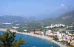
The largest lake on Earth by area is the Caspian Sea. This lake is salty. It has no connection with the ocean, so it belongs to the lakes, although it used to be part of the ocean.
Rice. 1. Photo of the Caspian Sea
The deepest lake is Baikal, 1642 meters deep. This lake contains 1/5 of all lake water in the world and is the most voluminous liquid freshwater body! The largest freshwater lake by area in the world is Lake Superior (North America).

Rice. 2. Lake Baikal on the map
Types of lakes based on the origin of the basins
Lake basin – the place (deepening) in which the lake is located.
Based on the origin of the basins, the following types of lakes are distinguished:
1. Tectonic
2. Glacial
3. Volcanic
4. Oxbowwomen
6. Karst
7. Thermokarst
The deepest lakes are tectonic, they are formed in cracks and breaks in the earth’s crust during its movement. Examples: Baikal, Teletskoye, Victoria, Tanganyika.
Zaprudnye lakes are formed in the valleys of mountain rivers when the riverbed is blocked by fallen rocks, a glacier, etc. Examples: Sarez, Ritsa.
Volcanic (crater) lakes are formed in the craters of extinct volcanoes. Examples: Toba, Kuril, Irasu.

Rice. 4. Kuril Lake
oxbow lakes are formed in the valleys of old riverbeds of lowland rivers when the direction of the river and channel flow changes.

Rice. 5. Scheme of the process of oxbow formation
Karst lakes are formed as a result of soil failure over voids.
Glacial The lakes were formed as a result of the melting of an ancient glacier. There are many such lakes in northern Eurasia and North America.

Rice. 6. Lakes of Karelia on the map
Other types of lakes
Lake waters are replenished by precipitation, rivers, snow melting, and groundwater.
According to their position, lakes are divided into:
1. Ground
2. Underground
According to water balance, lakes are divided into:
1. Sewage (at least one river flows from such lakes)
2. Endorheic (no rivers flow from such lakes)
According to the type of mineralization, lakes are divided into:
1. Fresh
2. Mineral (salty)
One of the saltiest bodies of water on Earth is the Dead Sea; its salinity can reach 350 ppm! Initially, the lake was called “dead”, because. They thought that living organisms did not live in it due to the high concentration of salt.

Rice. 7. Dead Sea Salts
The highest mountain lake
The highest mountain lake in the world is located at the foot of the highest volcano in the world - Ojos del Salado ( South America), which is located at an altitude of 6891 meters above sea level. This unnamed lake is a water-filled crater just 100 meters in diameter and up to ten meters deep.
Meteor lakes
This type of lake is formed when meteorites fall in meteorite craters, then these craters fill with water and turn into lakes. Example: Elgygytgyn.
Raspberry Lakes
These lakes are distinguished by their light pink color and pleasant smell. These lakes are given such properties by crustaceans, which, when dying and decomposing, give the salt a raspberry flavor.
Bibliography
Main
1. Basic course in geography: textbook. for 6th grade. general education institutions / T.P. Gerasimova, N.P. Neklyukova. – 10th ed., stereotype. – M.: Bustard, 2010. – 176 p.
2. Geography. 6th grade: atlas. – 3rd ed., stereotype. – M.: Bustard; DIK, 2011. – 32 p.
3. Geography. 6th grade: atlas. – 4th ed., stereotype. – M.: Bustard, DIK, 2013. – 32 p.
4. Geography. 6th grade: cont. maps: M.: DIK, Bustard, 2012. – 16 p.
Encyclopedias, dictionaries, reference books and statistical collections
1. Geography. Modern illustrated encyclopedia / A.P. Gorkin. – M.: Rosman-Press, 2006. – 624 p.
1.Federal Institute of Pedagogical Measurements ().
2. Russian Geographical Society ().
3.Geografia.ru ().
Hydrological types of lakes
The water mass of lakes is created by precipitation and groundwater. Sometimes fresh water replaces the marine one that filled the basin in the geological past. These are relict lakes, among them the Caspian Sea, Lake Ladoga and Lake Onega.
Lakes can be drainage (from which rivers flow), flowing and drainless (having no flow, mainly in semi-deserts and deserts). Very interesting is the endorheic Lake Chany, which, depending on fluctuations in seasonal or annual precipitation, is subject to sudden changes in outline. The nomadic lakes include: Lop Nor, Airy Chad.
Due to the large volume of water, the hydrological and thermal regimes of lakes are not as pronounced as those of rivers (see Rivers). On lakes there are no such impressive rises in water during high water and floods; ice formation and ice drift (most lakes in Russia freeze in winter) occur more slowly than on rivers. But there are strong waves, including seiches.
Fresh and salt lakes
Flowing lakes are overwhelmingly fresh and often have drinking water of unique quality (the most striking example is Baikal). Endorheic lakes are mineralized to one degree or another; salts accumulate in them (from 1 to 24.7% are brackish lakes, and from 24.7 to 47% are salty), contained even in the fresh water of their tributaries. There are also mineral lakes (which contain more than 47% salts), including flowing lakes, formed due to the flow of mineralized waters from the depths of the Earth. From them, salts may precipitate. For example, self-sedating lakes Elton and Baskunchak.
Anyone who was on the beach could see that the water in the sea tasted salty. But where does salt come from if fresh water enters the ocean through rains, rivers, etc.? Why is the sea salty and has it always been like this - time to figure it out!

How is water salinity determined?
Salinity refers to the salt content in water. Most often, salinity is measured in " ppm » (‰). Permille is one thousandth of a number. Let's give an example: a water salinity of 27 ‰ will mean that one liter of water (this is approximately 1000 grams) contains 27 grams of salt.
Water with an average salinity of 0.146 ‰ is considered fresh.
Average The salinity of the World Ocean is 35 ‰. What makes water salty is sodium chloride, also known as table salt. Among other salts, its share in sea water is the highest.
The saltiest sea is the Red Sea. Its salinity is 41‰.

Where does salt come from in the seas and oceans?
Scientists still disagree about whether seawater was originally salty or acquired such properties over time. Depending on the versions, different sources of the appearance of salts in the World Ocean are considered.
Rains and rivers
Fresh water always has no a large number of salts, and rainwater is no exception. It always contains traces of dissolved substances that were captured during its passage through the atmosphere. Getting into the soil, rainwater washes away a small amount of salts and eventually carries them to lakes and seas. From the surface of the latter, water intensively evaporates, falls again in the form of rain and brings new minerals from the land. The sea is salty because all the salts remain in it.
The same principle applies to rivers. Each of them is not completely fresh, but contains small amounts of salts captured on land.

Confirmation of the theory - salt lakes
Proof that salt comes through rivers are the saltiest lakes: the Great Salt Lake and the Dead Sea. Both are about 10 times saltier than seawater. Why are these lakes salty?, while most of the world's lakes are not?
Lakes are usually temporary storage areas for water. Rivers and streams bring water to lakes, and other rivers carry it away from these lakes. That is, water comes in from one end and leaves from the other.

The Great Salt Lake, the Dead Sea and other salt lakes have no outlets. All the water that flows into these lakes leaves only through evaporation. When water evaporates, dissolved salts remain in bodies of water. Thus, some lakes are salty because:
- the rivers carried salt to them;
- the water in the lakes evaporated;
- the salt remained.
Over many years, salt in the lake water has accumulated to its current level.
Interesting fact: The density of salt water in the Dead Sea is so high that it practically pushes a person out, preventing him from sinking.
The same process made the seas salty. Rivers carry dissolved salts to the ocean. Water evaporates from the oceans to fall again as rain and replenish rivers, but the salts remain in the ocean.
Hydrothermal processes
Rivers and rain are not the only source of dissolved salts. Not long ago, they were discovered on the ocean floor hydrothermal vents. They represent places where seawater has seeped into the rocks of the Earth's crust, become hotter, and is now flowing back into the ocean. Along with it comes a large amount of dissolved minerals.

Submarine volcanism
Another source of salts in the oceans is underwater volcanism - volcanic eruption underwater. It is similar to the previous process in that seawater reacts with hot volcanic products and dissolves some of the mineral components.