Gukh is the main Ural ridge. Gukh (the main Ural ridge) is a “star” base. Main Ural Ridge: how to get there
4 Feb 2015
Main Ural Ridge 2015 (Ski trip Northern Urals) (maps +GPS track)
Main Ural Ridge 2015 (Ski trip Northern Urals)
131 ZIL moves smoothly and confidently across the packed snowfield. The cabin is warm and cozy, the driver Yuri talks about rocket stages falling from the sky, about the illegal family business of gold panning, listens and is surprised about the Kuril Islands.

2 am on January 2, 2015, I begin to yawn, the turmoil of the past days lies on my shoulders, the New Year, a thousand-kilometer journey from Ufa to Severouralsk. Stop, at the invitation of the driver we go out into the cold, the frost is severe at 30 degrees. Tagir gets out of the kung, the rest of the group is lazy or sleepy.
We climb a small hill, and in the moonlight a white giant appears in front of us - the Main Ural Range (hereinafter referred to as GUKH), our goal and my long-time must-see destination. For a long time I wanted to lay a trail on it, but it just so happened that the Northern Urals, which lies only 800-1000 km from our native Southern Urals, are rarely visited by Ufa tourists, and the reason for this is simple: it’s not interesting to take a vacation and go, it’s too close, there are too many others more distant unusual places, and without vacation there is a catastrophic lack of time.
So GUH was on the wish list, waiting for the long New Year's weekend in 2015. 11 days is enough to complete an interesting ski route from Asia to Europe, starting in Sverdlovsk region Having finished in the Perm region, I decided. Luck was favorable and allowed us to assemble a strong and beautiful team of 7 people.
And so I stand and look at the white silhouette in the night, wishes invariably come true, the main thing is not to sit idly by, I think.
Having quickly chilled, we climb back into the cabin and the rest of the seventy-kilometer journey, to tourist base“Zvezda”, we pass without stopping.
At the entrance to the camp site, at the turn, there were several four-wheel drive passenger cars, people came to celebrate New Year. We set up a tent and fall asleep for 4 hours, dividing this short period of time into duty at the stove.

January 2.
We leave at 8.00. Descent from the road to the Zvezda camp site. The camp site is sleeping. Along the road well-worn by snowmobiles towards the ridge we climb to the southern tip of the GUKH, it’s frosty and above us clear sky, but according to the law of meanness, the horizon in the south and east is covered with a gray haze. There is no dawn.


We go out onto the snowy fields of the ridge; a giant desert with little snow stretches to the north, getting lost in the distance.

The snow is quite dense, but it’s harder to walk without skis, sometimes you fall through.

We move along the watershed all day, cross the peak 1189.7, Sosvensky 1204.5 and in the evening we descend into the forest zone.

15 km covered in a day. While the guys are setting up camp, I’m following tomorrow’s path a couple of kilometers up the ravine to peak 1166.3

Let's try our local know-how. For the first time, we took with us a small chainsaw and 1.5 liters of gasoline. The result exceeds all expectations. The process of collecting firewood is simplified and accelerated significantly.
January 3.
The night passed calmly and warmly, the wind increased and the weather worsened. Howls are heard overhead. I suggest you still try and go to the top, the guys agree. We start at 8.00 on the ski track and then through dense snow we go beyond the peak of 1166.3 to the plateau of the ridge.

Strong wind and zero visibility, but we can go, we go in a dense group, the speed is high. Traversing peak 1153.0 on the descent there is a problem with the skis, I discover a crack.

The Northern Urals sastrugi could not withstand “Vyatka”. After lunch, the weather deteriorates, we decide to go down to the gully emerging from under the peak “Ridge 1338.6” while we are going to the ravine, the wind is getting so strong that we can calmly lean forward and, leaning against its flow, stand without falling. The descent into the forest area causes some difficulties, the slope is quite steep, interspersed with soft snow, firn and kurum outcrops, all this against the backdrop of strong winds and a blowing snow that sometimes hides the participants of the descent. At such moments you understand how true the eastern proverb is: “a man in the mountains is like a tear in the eyelashes of Allah.” The mountain sweeps us down like a dog shakes off water, in one easy movement.

The last 200 metro is not a descent, but an escape, faster into the forest zone, under its protection, from this fierce wind. 15 km covered, and approximately 40% of the ridge. In the evening, a council of technicians consisting of Shamil Nuryev and Alexey Bolotov performs a complex operation on the ski. The result, as time will tell, is excellent.

4 January.
The weather is finally turning bad. It is warm, it snows periodically, clouds cover the ridge from a height of 700-800 meters. We walk along the edge of the forest zone, 20-50 meters above it.

Snow is dense, now. There is almost no path. We walk 15 km in a day and stand in the area of the southern source of the Lyampa Kutimskaya River under the mountain of the same name, the highest point of the ridge.
Tomorrow we are planning a radial climb to the top. We hope that the weather will clear up, although, of course, there are no prerequisites for this.

5 January.
We leave an hour earlier than usual, at 7 am. Dawn in 3 hours, until sunset 9.

In total, daylight hours at a given latitude last about 5.5 hours at this time of year, which also makes adjustments to the movement of the group.
The weather has not improved, it is cloudy, sometimes there are loads of snow, we return 1 km back and climb to the ridge along the gentlest slope in this part of the ridge. We go to the watershed on skis, the ski jumper works excellently, although our comrades also climb without it without any problems, but if the whole group was on the ski jumper, we could just go straight and up, without lengthening the route with endless meanders along the slope. Having reached the ridge, we leave our skis and traverse about another 1 km to the top of Lampa Kutimskaya (Humbolt).

10 minutes before sunrise we are at the top. There is milk all around, one can assume that the ascent was done solely for show, not for show, we eat a chocolate bar and go down.

We are lucky, the wind is not strong, we quickly reach the skis and, scooping them up, begin to descend, no matter how much we would like to put on the skis and slide down, this is absolutely impossible.

There is white nothingness around us, everything merges and visibility is no more than 10-20 meters. In such conditions, it’s easy to break your skis or break your head. When the slope flattens out significantly, we put on our skis and immediately understand how we did the right thing, without trying to ski down higher, it seems that a small slope and a smooth descent in conditions of complete disorientation play strange tricks on the mind. At one point in the descent, I realize that I’ve been standing still for some time, but my brain is sending confident signals that I’m moving. Any surface irregularities occur unexpectedly and cause falls.
By noon we go down to the tent, have lunch and decide to walk another 5-7 km before sunset.

We go to a separate kurum peak, rising in the middle of the forest. We stand on one of its terraces with an excellent view of the route we have taken. Taking into account the radial distance, 18 km were covered.

6th January.
Life returned to normal. Rise at 6 a.m., breakfast in bed, leisurely preparations and at 8 a.m. the group is on the route.
A small section through the forest, and again onto a dense snow-covered slope, it’s good to go. At some point, Tatyana notices the glow of a fire below in the valley in the middle of the forest. We shout, and after a few minutes they answer us with flashlights. People are standing under the pass across the western side spur of the ridge, it is logical to assume that they came from the north, and if so, it means that our ski tracks coincide in some part, it would be a shame not to use the ready-made ski track.

We go towards them, in the area of the northern source of the Lyampa Kutimskaya River we meet the tail of a large group. Tourists from Perm, Meridian tourist club. The group is large, 23 people, as often happens, the head does not know what the tail is doing and vice versa, all our attempts to find out the route fail, no one can really explain the route and the place of the supposed drop. This is very strange for us. At each stop, maps and navigators walk around all group members. Having said goodbye to the Permians, we climb up to the pass in the milk, the ski track is lost on the dense blown snow, and we again lead our own. The weather is clearly improving, the sky is turning blue in the gaps.

When descending into the forest from the left slope of the western spur of the ridge, it gets significantly colder. Literally with every step it becomes colder, apparently the cold air lingered in front of a natural barrier and sank into the valley of the Bolshaya Paimara River. We decided to get up early, at the top 684.0, with an excellent view of the GUKH,


in the evening we have the pleasure of observing a little sunlight and the giant snow-white ridge we have covered in 5 days. 13.5 km covered.
Jan. 7.
So we broke out of the GUKH, we are trailing through the forest towards Mount White Stone, the snow is deep, it’s hard to trail, but against the backdrop of a strong cold snap, this is rather a plus. Coming out into the clearing, I turn to the south and rejoice at the wonderful picture: the cyclone is leaving, as evidenced by the many lenticular clouds blazing in the dawn rays above the ridge.

A couple of hours before sunset we go out to the southern slopes of White Stone, the sun is shining brightly in the blue sky, the frost burns our face. There was a fire here, the trees are bare and dead.

We find a convenient site and decide to immediately go to the top of the mountain, while there is time and weather. A steep climb and we reach the summit plateau, Mount Shudya-Pendysh sparkles in the west,

and, indeed, it somewhat resembles Manaraga, we will go to it tomorrow, but for now, forward to the top! On the plateau there is forest-tundra, transformed into heroes of snow fairy tales.

Shamil and Dinara are a little behind, resolving some issues at the bivouac, and Andrei and Tagir go ahead, trailing the ski track to the top. We stand in complete calm and admire the surrounding views, but the serenity disappears when the gaze reaches the top of the ridge; it’s strange that it’s quiet here, but literally a couple of kilometers along the entire 200-meter climb there is a strong wind. And if you consider that the temperature is no higher than 30 degrees, the prospect becomes completely unpleasant. I share my thoughts with Lesha, saying that just the sight of these snow flags makes me feel cold.
Lesha asks if it makes sense to go upstairs in this weather, I think it’s worth a try, especially since the guys have already begun to climb to the top, they are clearly visible to us on its snow-white edge.

Tanya and I leave our skis below the peak and begin the climb; it’s blowing hard and with every meter of ascent the wind speed increases. We involuntarily climb to the east, under the protection of the slope from the westerly wind, and so we rise to the first step.
One step from behind the slope, taken by me onto the flat surface of the step, and I understand the complete meaninglessness of what is happening. I can’t see anything, fine snow dust fills my eyes, the wind blows right through. No, there’s no point in going to the top, it’s still about 1.5 km away, and the sun is almost at the horizon. A couple more seconds and my eyes are stuck together, I can hardly discern the path of descent, the mask on my face has frozen over and turned into a rigid structure. I turn Tanya around and down, we get to Lesha, he says that the guys are not visible and he is worried about them.

I don’t feel much anxiety, I’m sure they couldn’t have gone much further than I went, and the visibility on the mountain is excellent, but we separate, Lesha in a ski mask goes up higher to see where the guys are, and I go down with the rest of the guys to the foot. We wait below, after 10 minutes all three appear on the slope and descend towards us. The evening and sunset are stunningly beautiful, very delicate colors.


In the parking lot there is a small problem with the chainsaw, last night it was warm, today it’s a fairy tale and the sawdust that has accumulated on the chain has frozen and does not allow it to move.
All this is cleaned off and we, without going far, cut down 3 medium-sized burnt spruce trees. Apparently, the fact that we get up later than usual, choose trees in the dark, more tired than usual, plays a cruel joke on us, in the evening in the tent it turns out that some of the firewood is damp and burns poorly, and to top it all off, the temperature drops significantly . This night becomes the coldest and smokiest of our ski trip.
Over the past day we covered 18.4 km.

January 8.
Everyone is angry as hell, the smoky cold night did not allow us to rest, especially since the morning is clearly colder than yesterday evening, we begin the journey by descending into the valley of the Left Rassokha River. It’s easy to go down and it’s very cold; your hands and feet quickly get cold and are reluctant to warm up after intense work. The cold by the river is unbearable, it’s time to take a walk, but without slowing down, we make our way up in the deep, loose snow, and that’s the only way to warm ourselves up.
The sun rises in a clear blue sky, the anticyclone continues to pamper us with wonderful views. Almost the entire walking day we walk through the forest, climbing an unnamed forested ridge. After lunch we go out to a clearing, which rewards our eyes, hungry for views of the mountains during the day.

Here she is Shudya-Pendysh, very close, a beauty in a white veil woven by the western wind. But we will only be on the mountain tomorrow. Another couple of kilometers and we stop for the night on the edge of a large clearing.

15 kilometers covered.

January 9.
In the morning we go to the mountain lightly, hoping to be at the top by dawn. We climb high on skis on dense snow, further, where the mountain slope begins to climb up, quite steeply, we take off our skis and go on foot. The snow is dense and lighter comrades easily go up, I carry a backpack with the things necessary for the radial exit and fall heavily.
From time to time I turn to the horizon and am annoyed at the haze that covers its edge; apparently a beautiful sunrise may not please us today.

At the top, a cold wind blows, traditional chocolate and the anticipation of magic, the moment when the sun appears over the edge of the Main Ural Ridge. Our entire journey is in full view, past and future, the endless ocean of the taiga ripples at our feet, in places with white mountain tops, like white lambs on the crests of a wave. 
The haze clears a little, and here it is, the most exciting and wonderful moment of the day, his birth. The red sun slowly rises over the ridges, illuminating the world with light.

We admire it for a bit, take a group photo and begin our descent.
At the foot, Tanya and I pause to take photographs and find ourselves in the indescribable beauty of the morning light. For the second year in a row in January I see such light and color, unreal, bright, tender! On the opposite side of the sunrise is turquoise!


In the direction of the sun, soft pink, red, purple... the colors change on the snow-white leaf of the mountain. We take pictures without feeling our fingers, probably at this very moment Tanya in Once again freezes their ends, but for such moments it is worth suffering, for such moments it is worth doing ski tourism. You will never see such pristine and delicate beauty anywhere in the city.

But this golden morning hour is short, the colors change like in a kaleidoscope, and now the sun is bright and harsh. Let's go, let's go to civilization! Soon, according to the map and satellite images, a road and logging should appear.

We reach it 2 hours before sunset and walk another 5 km along the road. The road is wonderful, perfectly cleaned, suitable for passenger cars, it is used for exporting timber, and from time to time KamAZ trucks loaded with timber overtake us.

In the lumberjacks' trailer we learn that at night the thermometer dropped to -45, and even now it is not much warmer. The sun goes below the horizon, and we get up for the night.
As always, when people begin to smell the “smell” of civilization, fermentation begins in their minds...
According to the plan and agreement with the Solikamsk travel agency “Argo”, we have one more crossing, an overnight stay in the area of the bridge across the Uls River, and only on January 11 at 9.00 a minibus should pick us up. Alexey suggests the option of trying to get a passing KamAZ truck to the village of Vaya and either calling a minibus earlier, or organizing an intermediate drop-off to the village.
The proposal is not without meaning, and everyone wants to have at least one day before going to work, so we decide that in the morning Alexey will go out to catch a passing KamAZ, and we will walk to the bridge over the Uls River, taking his skis.
It’s strange, the firewood in the tent is burning happily, but the heat we’re used to is still not there. All corners are covered with frost more abundantly than usual, the bright moon illuminates the “space” outside the tent, the mountains are visible for many kilometers around.
We walked 19 kilometers during the day.

January 10.
We hear the noise of KamAZ trucks all night, which is reassuring. After breakfast, Alexey goes into the darkness to watch for a ride on the road, we also slowly collect our things. An hour later I leave the tent, judging by the fact that we did not hear the noise of the engine, Lesha is still on the road. Very cold. I select coals from the stove, take an armful of the remaining firewood, take it to the road, the fire will warm...
After 30 minutes, the first empty KamAZ passes in the opposite direction, in Vai it was 49, it’s clear why they didn’t heat the wood!
At 8.30 we leave towards Vai, Alexey is still on the road. There is a descent in front of us, we put on our skis and go down.

Usually the descent is a joy, but in this situation it becomes a problem; it is several kilometers long and freezes very quickly. Oh thank the gods, the road went uphill! We tie the skis behind and forward intensively upward. How is Lesha doing alone on the road... After 30 minutes I notice a lonely point behind me. There are no options, our friend is catching up with us, we are waiting. He comes up and says that there is no point in waiting alone and goes with us. The right decision, the first loaded KamAZ appears only 2 hours later and picks up our friend, leaving the cold news that it is now about -45 degrees.

It’s the first time I’ve encountered such temperatures, it’s the first time I can’t stay warm for a long time, walking uphill under a heavy backpack. So, almost without stopping, we fly the remaining 20 kilometers to the bridge over the Uls River.

Right at the bridge, a timber truck stops and the driver who picked up Lesha tells us that in 2 hours a car will come for us. Great news! But we need to pass this time, and it is absolutely impossible to stand in the cold.
20 minutes of well-coordinated work and we are in the tent, the firewood is making a cheerful noise, the hero of today arrives in a passing KamAZ, with good news, reports that the bus will come for us today, that the office was not surprised by his call, they said that the bus has already left for us , since they were sure that we would leave earlier due to severe frosts. Such insight is amazing.
Literally 30 minutes later the bus arrives. We quickly assemble the tent, load up, take the last photo and head into the warmth of a hot car.

Warmth spreads throughout the body, arms and legs swell, a long road home lies ahead...
And 50 grams of cognac for Victory!

Figures for a ski trip in the Northern Urals
1. running days 9
2. Distance covered 150 kilometers
3. Travel budget 12 tr. per person.
4. Throwing - throwing:
– Ufa – Severouralsk. Minibus FIAT. Driver Stanislav 89899547563. Best recommendations.
– Severouralsk - t/b Zvezda. GAZ 131 with kung, UAZ. Yuri 89045421768 He is engaged in transporting tourists all year round. Best recommendations.
Leonid is also involved in transportation. URAL. 89045479000
– Vaya – Ufa. The transfer was organized by the Argo travel agency. http://argoturs.ru, best recommendations.
Photo Oleg Chegodaev, Tatyana Olkova
The Main Ural Range, or simply GUKH, is a chain of mountains stretching from south to north, separating the European and Asian parts of Eurasia. The length of the ridge exceeds 50 kilometers; it is the largest mountain range in the Ural Mountains chain. It includes several large mountains that are of great interest to tourists. Also, the Main Ural Range is the administrative border Perm region and Sverdlovsk region. Visiting these picturesque place will open for you the very heart of the Ural Mountains.
Mount Humboldt - among the Ural Mountains
The most high peak in the system of the Main Ural Range (GUR) is Mount Humboldt. Its height is 1410 meters. The top of the mountain is located in the Sverdlovsk region, the foot of the western part is in the Perm region. Until the 21st century, the mountain was called Lampa Kutimskaya, named after the Lampa River, flowing from the foot. Next, the Lyampa flows into the Kutim River, which is part of the Vishera River basin.
Mount Humboldt is interesting for its harmony. Half of the mountain, 700 meters, is occupied by forest, and the second half is occupied by rocks made of kurumnik. From north to south the mountain stretches for 5.5 kilometers, from west to east for 4 kilometers. The slopes of the mountain are quite steep, so snow melting is possible in winter. The most convenient time to visit the mountain is from June to September. Already in the first month of autumn, the first snow and the establishment of snow cover are possible.
The path to Mount Humboldt is organized through the Sverdlovsk region. The casting begins in the city of Severouralsk, from which the Main Ural Range is 40 kilometers away. When visiting the mountain, we recommend using the services of a guide who knows the area. Despite the fact that climbing the mountain does not present any great difficulties, the services of a guide will help you choose the most suitable one. optimal route and won't get lost.
GPS coordinates of Mount Humboldt 60°22’21.63″N 59°11’00.94″E
Kazan stone - memory of gold
It is located in the eastern part of the Krasnovishersky district of the Perm region. The southwestern part of the Main Ural Range (GUR) chain. The height of the Kazan Stone is 1035 meters above sea level. Despite its relatively small size, it dominates the area. Stone is a favorite place for tourists with an initial level of training. This is where you can begin your acquaintance with the Main Ural Range.
Kazan Stone is covered with forests up to approximately 800 meters. Further about 200 meters there are rocks from kurumnik. The shape of the mountain is dome-shaped and the top is flat. Kazan Rock is not as steep as Mount Humboldt, which is why it is recommended for beginner hikers. The snow cover melts at the end of May. The mountain is open to tourists both in summer and winter.
The toponymy of the mountain is of great interest. Scientists believe that the name of the mountain was given by the Kazan gold mine located nearby. The mine operated from the beginning of the 20th century, and was closed after the depletion of gold-bearing rocks in the middle of the century. The Surya River, where gold was mined in the past, originates right at the Kazan Stone. Also, the Polkhovka River originates here, the waters of which flow into the Uls River.
Among other peaks of the Main Ural Range, Sosvinsky Stone can be distinguished. This mountain is located in the southeastern part of the ridge, next to the Kazan Stone. The height of the Sosvinsky stone is 955 meters, so it is somewhat lost in sight of the Kazan stone. Climbing the mountain is not very difficult, so it is also suitable for beginner hikers.
Diary of the trip.
The Main Ural Ridge - this is a pompous name for a mountain range stretching for 50 km. located clearly from north to south on the border between the Perm and Sverdlovsk regions, the border itself runs in the center along the entire ridge. The nearest cities are Severouralsk and Solikamsk.We decide to explore this route. There are practically no descriptions on the Internet, so we develop the route ourselves at our own peril and risk. Severouralsk - Pokrovsk-Uralsky - Bayanovka and further along the road to Kvarkush. What kind of road? Is it possible to drive along that road? How close can you get? Where to leave the car? Which side and along which paths should we go? And is it even possible to go there?
In general, we struggled with these questions for two weeks.
Having connected the weekends of all participants, the departure was scheduled for 12 am on Friday, September 6, we need to turn around in one day, but we still haven’t found any answers.
Friday, September 6 - by chance (all accidents are not accidental) I stumbled upon the phone number of the owner of the Zvezda base, which the road passes by, I called and received answers. Hallelujah! Gismeteo promises a weekend without rain in that area. The best!
According to the plan, at 12 at night we leave Yekaterinburg, the highway to Serov, we are fined a couple of times - an entrance ticket to the North.
Here is Severouralsk - we cross the bridge over the canal and immediately turn left (bypass), we go to the second gate made of pipes above the road, and immediately turn left to Pokrovsk-Uralsky, the village remains on the left side to us on Bayanovka. Bayanovka was also supposed to remain aside, but somehow we were drawn there, the navigators categorically refused to show the direction and circled around the village with us, recording the track.
Saturday, September 7, 5 a.m. - we took the road to Kvarkush. It rained all week along the logging road, respectively 56 km. We drove this road in 2.5 hours. It starts to rain - the gismeteo did not disappoint!
8 am - we are at the base - the rain is not letting up, the ridge is covered in fog. Where to look for the trail? While they were drinking tea and getting ready, base worker Alexey appeared and said: “I saw you a long time ago, but I didn’t want to go out in the rain!” He cast a sad glance over our table, where there was nothing stronger than chicory, explained where to look for the trail, was sincerely surprised that we would climb the mountains in the rain and fog and, as an alternative, offered us a bathhouse, chatted a little more, and, having lost to us interest went into the house.
At 8:30 we set off in the direction indicated by Alexey. This year, having wandered through off-road terrain, kurumnik, windbreaks and swamps, we were ready to meet it all again, but the spirits of the mountains, through the hands of the aborigines, decided to give us a gift - flooring made of boards. And we walked along this flooring, like a red carpet, to the foot of the ridge. Thank you and greetings Spirits of the area. We install the neutralizer and get a bonus - the rain stops!
The mountain is completely made of kurumnik! The rains washed away the soil from under the stones, the stones are unstable and mobile, the moss on the stones became soft and slippery. The grip of track shoes on rocks is zero. So what now - we won’t go up? We will, but we’ll just go more carefully, especially since we’re light, so everything will work out!
The top is shrouded in fog, it’s a pity we won’t see all the beauty and all the greatness. Being careful, but also trying not to lose pace, we climb up. It seems that this is the top, the base is visible far below from behind, and ahead of us the next climb is visible from the fog, and beyond that there is another.
The fog was apparently bored, so he started a game with us, now that we are in the middle of the ascent, the fog slid down, revealing the peak in front of us and covering the foot of the mountain.
Seeing the top, Marina rushed forward (after all, you need to take a heavier backpack with you for such particularly nimble ones) before this thought had time to flash, part of the fog covered Marina, and she had to stop so as not to lose sight of us. Well, Yulia was climbing behind (she has no experience in walking on the ridge), Ilya belays her, fog creeps up on them from behind, and we periodically lose sight of them. So what should we do now? Will wait! Fortunately, there is something to do - small islands of grass among the kurumnik - this is a blueberry paradise. We started eating blueberries, blueberries, lingonberries and some other berries that were also very tasty (we still haven’t learned the name). And so the entire climb, while waiting for Yulia, we grazed on the blueberry islands, agreeing with each other that it was probably good that Yulia walked slowly!
The last third step was climbed on all fours - a steep climb of 60 degrees, the stones under our feet crawl and crumble, we walk at a distance so as not to cover each other with stones.
Here is the peak height of 1070m, and the most high point GUHA is Mount Humboldt - 1410m. after 40 km. from us to the north. The distance is covered in fog, it’s a shame I really wanted to see Konjak, Denezhkin Stone, Kvarkush. We are looking for a place for the converter, well, of course, the fog is right there, but without it, now we can’t see even the next 5 meters.
Connection with peacemakers, thought form, launch! The fog clears a little. After spending a little more time alone with the mountain and ourselves, we begin the descent, no less extreme than the ascent, and again enjoy Yulka’s slow movement in the blueberry meadows.
Now the fog has hidden the foot from us, so it can’t sit still, and we get a little lost on the path, the especially nimble ones completely take to the left and get lost in the fog, okay, at least you can hear your voice (after all, some people need to tie weights to their legs). Here is the path leading to the base.
The mountain evoked very positive emotions. Fabulous place, blissful, very pleasant and inviting, friendly. I wanted to stay there for 3-4 days, completely disconnect from the bustle of the city and merge with the nature of this place, take a steam bath, swim in the stream, and walk along the ridge to the north. (The cost of accommodation at the base is 500 rubles per day. The bathhouse is included in the price, the phone number of the base owner is 8 953 608 1006 Vasily Ivanovich).
It’s 2 p.m. We change clothes and have lunch. Thank you all and God bless you on your way back.
An extreme logging road, we meet a group of quad cyclists - that's who have the freedom, all dirty up to their ears, but terribly happy. Closer to the village there is a local population, apparently they have gone for mushrooms and pine cones, and the hunting season has begun (maybe it never ended).
B-a-i-n-o-v-k-a - we are trying to drive using the navigator, but for some reason we are cutting circles around the village. It’s a depressing sight: abandoned houses, dirt, garbage dumps, no living creatures of any kind - devastation. I remembered the villages of Bashkiria and Kazakhstan - solid houses, clean courtyards, streets full of chickens and geese, herds of cows in the fields, herds of horses. And it became a shame for the state!
Meanwhile, the boys realized that we were driving along the track recorded by the navigator at night and began to get out of the village with the cheerful name Bayanovka. We looked at the picture of the track on the navigator, it turned out that we drove around the entire village in a circle, stopping at all four exits, something like a four-pointed star (now the thought came - a neutralizer). Well, let everything go well for them now! Amen!
Here is Severouralsk, what kind of city they have beautiful church and stands on high place, so it is visible from all sides. That's it, now it's a direct road to Yekaterinburg. And this is just the beginning of the journey...
Good time everyone!
I’m starting a series of posts about a trip to the Ural Mountains 2012.
I'll start from the end))
Today I will tell you in a nutshell about the wonderful place, the Zvezda recreation center, which is located at the foot of the GUKh.
From the city of Severouralsk, which is located in the Sverdlovsk region, there is a road through the villages of Bayanovka and Pokrovsk-Uralsky.
This road crosses Ural mountains and taiga and abuts the Kvarkush ridge.
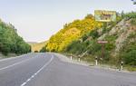
It’s easy to find the base when you drive along this taiga gravel road; on the right there will be a turnoff on which stands an Iron Star, such a small greeting from the USSR.
Going down to the base, you will see cozy houses located in a small clearing, with stunning views of the Main Ural Range.
1.
It seems that the mountains are small and not high here, but you need to remember that the base itself is located at an altitude of almost 700 meters above sea level.
2.
Prices at the base are very cheap, a day costs 500 rubles per person, which includes living space with a bed, use of a kitchen,
where there is gas and a Russian stove, a bathhouse, and if you want barbecue in the evening, they will prepare everything for you.
You can play billiards, sit by the fireplace, watch TV with your favorite films.
Here and there there are benches and gazebos, barbecues where you can sit romantically with a friend, chat with friends,
or simply sit quietly and enjoy the surrounding wildlife.
3.
There are very kind and friendly guys working at the base itself. The director is also a very interesting person, a real Russian man, as are the base workers (but we won’t talk about that today).
The uniqueness of the base lies in the fact that you can come up with a lot of entertainment...
So many...
Let me give you a few examples:
You can stupidly come to the base, sit on its territory, drink beer, eat barbecue, go to the bathhouse...
But this is not all about us, and sadly many people come there for this...
But what’s the point if the most ancient mountains on the planet are under our noses, and we weren’t driving to sit still...
From the base itself there is a trail all the way to Gukha, where there is a place for fires, gatherings, etc. literally 15 minutes from the base.
But we are not so lazy and want to move on...
The base workers laid a marked trail up to the plateau, + tourists trampled...
a leisurely walk, 30-40 minutes and we are at the top, from which a wonderful view of the surrounding mountains opens up, and in particular Mount Denezhkin Kamen and its reserve.
You can buy a permit in advance to go to the reserve and make a foray to it, walking along the ridge or along it to the north. Excellent route, three days at the base,
then you get ready and go to the reserve with your backpacks, then back to the base and relax.
4.
You don't have to walk that far, for the lazy)).
We move on, when we have reached the top according to the marks, we rise to a plateau that takes us to another planet...
Here you can find lunar and Martian landscapes, and whatever you want....
5.
The view from the plateau cannot be described in any words; every meter you can take pictures and take pictures...
We walk along the plateau towards the Perm region, the border of our region and the Sverdlovsk region runs clearly along the center of the ridge, on one half of the plateau you are in the Sverdlovsk region, on the other half in the Perm region...
moving to Perm...
6.
Coming out to the opposite edge of the plateau, a view of the valley opens up, and ridges, mountains, ridges, mountains... You even begin to feel dizzy... from delight and views.
7.
By the way, in the valley exactly in the middle there is a house where tourists, hunters, fishermen stay...
Here’s another route for you, live at the base, then go to a house for a few days, live there, live a clean life, cook firewood, pick millions of berries and mushrooms,
walk to the surrounding peaks and admire and admire....
8.
You can also go north from the base along the stream, reach where the stream becomes the Sosva River and catch fish there, grayling, taimen too.
but we are on the ridge and admiring the views....
If you go down to the house in the valley, you can see GUH in all its glory....
9.
and if you move to the opposite side of GUKH and the plateau from which we descended, then you can look at everything at once! there you can see the Kazan stone, from which there is a wonderful view, and you can climb the “Chalice” or go down to a height of 1300.
Here is a panorama view with "bowls"
10.
You can also drive about 25-35 km along the road from the base, I don’t remember exactly now, and go to the Zhigalan waterfalls for a couple of days; it’s easy to find information about them on the Internet.
This is such a wonderful base, such a Vedic place, such a Northern Urals.
In the full report I will tell you how I got there, how I communicated, what I saw there, and of course a bunch of photographs from the ridge and from the surrounding peaks and the house))
By the way, there is not just one house, but several, you can live in each one, because each one is located in different places, with its beauty and romance.
By the way, I almost forgot, you can ski here until June 15th.
What the guys from Tchaikovsky did successfully was some kind of ski section.
so there’s plenty of entertainment there, the main thing is imagination and asking good questions from director Vasily.
The base lacks a normal website where all the surrounding routes and other advantages will be described, but I think this is all ahead.
The most important thing to remember is that we need to respect the beauty around us, not litter and behave with dignity, like a human being!
And finally, I’ll show you a few more photos from the trip...
The Ural, such a Ural, mysterious as in fairy tales, and pure as a romantic tear :)
11.
12.
13.
14.
All the details are in the full report, there is a lot of material to prepare, so everything has its time.
All the best!